Neu-Hussenbach was founded in 1860 by colonists from Hussenbach, Dietel, Huck, Norka, and Grimm. It was located along the Gashon River from which its Russian name was taken.
Today, what remains of the former Volga German settlement of Neu-Hussenbach is known as Pervomayskaya.
As of 1910 there was a Lutheran church in Neu-Hussenbach. The congregation was part of the parish headquartered in Brunnental where the pastor resided.
|
Year
|
Households
|
Population
|
||
|---|---|---|---|---|
|
Total
|
Male
|
Female
|
||
| 1886 |
|
|
|
|
| 1891 |
|
|
|
|
| 1894 |
|
|
|
|
| 1897 |
|
2,274*
|
1,137
|
1,137
|
| 1904 |
|
|
|
|
| 1910 |
349
|
4,179
|
2,092
|
2,087
|
| 1912 |
|
6,624
|
|
|
| 1920 |
434**
|
2,925
|
|
|
| 1922 |
|
2,049
|
|
|
| 1923 |
|
2,060
|
|
|
| 1926*** |
422
|
2,148
|
1,040
|
1,108
|
| 1931 |
|
4,255****
|
|
|
*Of whom 2,219 were German.
**Of which 428 households were German.
***Of whom 2,142 (1,036 male and 1,106) in 420 households were German.
****Of whom 4,138 were German.
Hussenbach (wolgadeutsche.net) in Russian.
Hussenbach web site.
- List of the Populated Places of the Samara Province. Samara, Russia, 1910.Preliminary Results of the Soviet Census of 1926 on the Volga German Autonomous Soviet Socialist Republic (Pokrovsk, 1927): 28-83.
- "Settlements in the 1897 Census." Journal of the American Historical Society of Germans from Russia (Winter, 1990): 16.
50.934667, 46.751667
Migrated From
Immigration Locations
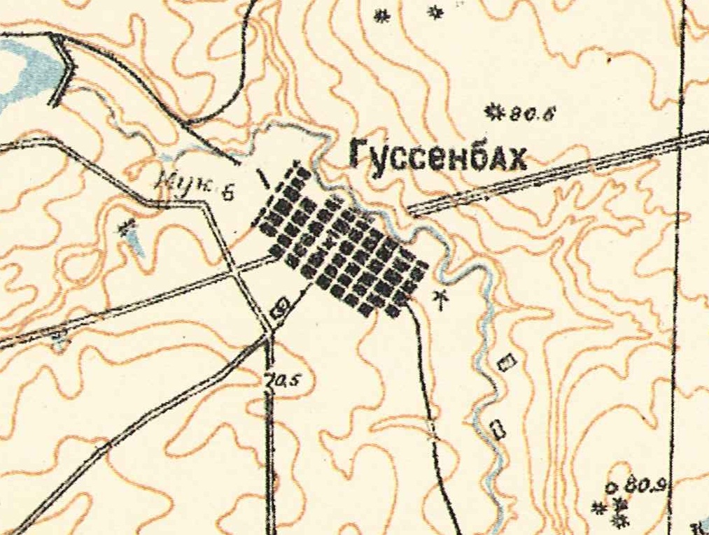
Map showing Neu-Hussenbach (1935).
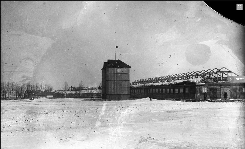
Dairy barn on the Neu-Hussenbach collective farm (1931).
Source: RGAKFD collections, Krasnogorsk, Russia.
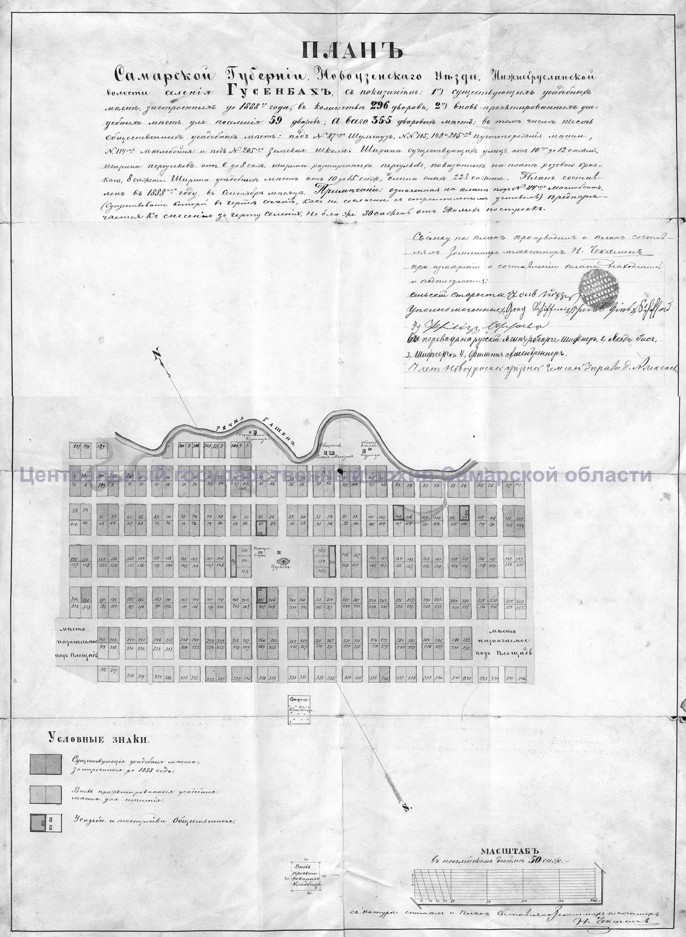
Map of Neu-Hussenbach (1888).
Source: Samara Archives.
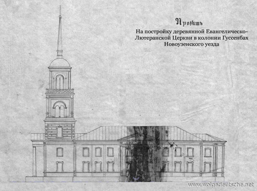
Architectural rendering of the Lutheran Church in Neu-Hussenbach.
Source: Wolgadeutsche.net via Jorge Bohn.