Dietel was founded on 1 July 1767 by 43 colonist families that had been recruited by Baron de Boffe from the Pfalz, Württemberg, Hamburg, Saxony, Mecklenburg, and Alsace.
The colony took its name from the first leader of the group that settled there, Christian Gottfried Dietel from Saxony.
Today, the former colony of Dietel is known as Aleshniki. Local residents have erected a memorial to honor those inhabitants of the village who served in the military during World War II. Included on the monument are also those Volga Germans who served in the Russian Army from June to August in 1941.
The Lutheran congregation in Dietel was established in 1767 at the founding of the colony, and served as the lead parish for the congregations in the colonies of Kautz, Kratzke, and Merkel. Dietel also served as the residence of the pastor serving these parishes.
In 1904, the congregations in Neu-Dönhof and Neu-Balzer located to the north were added to the jurisdiction of the Dietel parish.
Today, nothing remains of the church that once stood in Dietel. A statue of Lenin marks the location.
The congregation in Dietel was served by the following pastors:
- 1768-1770 Sigismund Israel Bergen
- 1772-1774 Gottlieb May
- 1780-1782 Laurentius Ahlbaum
- 1793-1798 Johann Heinrich Buck
- 1801-1815 Karl Jakob Früauf
- 1819-1835 Andreas Anton Haag
- 1835-1862 Gotthard Alexis Marpurg
- 1864-1880 Ernst Gottfried Carrolien
- 1887-1892 August Julius Tiedemann
- 1893-1927 Johann Friedrich Möllmann
- 1929-1931 Woldemar Wagner
|
Year
|
Households
|
Population
|
||
|---|---|---|---|---|
|
Total
|
Male
|
Female
|
||
| 1767 |
|
|
|
|
| 1769 |
68
|
284
|
158
|
126
|
| 1773 |
72
|
351
|
202
|
149
|
| 1788 |
69
|
445
|
227
|
218
|
| 1798 |
78
|
502
|
241
|
261
|
| 1816 |
91
|
939
|
471
|
468
|
| 1834 |
191
|
1,739
|
892
|
847
|
| 1850 |
194
|
2,561
|
1,310
|
1,251
|
| 1857 |
230
|
3,167
|
1,616
|
1,551
|
| 1859 |
250
|
3,181
|
1,609
|
1,572
|
| 1886* |
388
|
3,510
|
1,805
|
1,705
|
| 1891 |
347
|
4,652
|
2,346
|
2,306
|
| 1897 |
|
3,172**
|
1,534
|
1,638
|
| 1911 |
|
3,285
|
|
|
| 1920 |
425***
|
3,371
|
|
|
| 1922 |
|
2,752
|
|
|
| 1923 |
|
2,880
|
|
|
| 1926 |
458****
|
3,128
|
1,531
|
1,597
|
| 1931 |
|
3,402*****
|
|
|
*Not counting 110 families who are permanently absent (accounting for 975 men and 962 women).
**Of whom 3,135 were German.
***Of which 414 households were German.
****Of whom 3,114 (1,531 male & 1,583 female) were German living in 449 households.
*****Of whom 3,392 were German.
Dietel (wolgadeutsche.net) in Russian
Folks Family Trees (Kay Broach Suber)
Reichel/Reigel Family History (Annette Parish)
- Beratz, Gottieb. The German colonies on the Lower Volga, their origin and early development: a memorial for the 150th anniversary of the arrival of the first German settlers on the Volga, 29 June 1764. Translated by Adam Giesinger (Lincoln, NE: American Historical Society of Germans from Russia, 1991): 349.
- Diesendorf, V.F. Die Deutschen Russlands : Siedlungen und Siedlungsgebiete : Lexicon. Moscow, 2006.
- Minkh, A.N. Historical and Georgraphical Dictionary of the Saratov Province (Saratov, 1898): 705-709. Online.
- Orlov, Gregorii. Report of Conditions of Settlements on the Volga to Catherine II, 14 February 1769.
- Pallas, P.S. Reise durch verschiedene Provinzen des Russischen Reichs. Theil 3,2, Reise aus Sibirien zurueck an die Wolga im 1773sten Jahr (St. Petersburg: Kaiserl. Academie der Wissenschaften, 1776): 622.
- Pleve, Igor. Einwanderung in das Wolgagebiet, 1764-1767 Band 1 (Göttingen: Der Göttinger Arbeitskreis, 1999): 279-296.
- Preliminary Results of the Soviet Census of 1926 on the Volga German Autonomous Soviet Socialist Republic (Pokrovsk, 1927): 28-83.
- Schnurr, Joseph, Die Kirchen und das Religiöse Leben der Russlanddeutschen - Evangelischer Teil (Stuttgart: Landsmannschaft der Deutschen aus Russland, 1972): 192.
- "Settlements in the 1897 Census." Journal of the American Historical Society of Germans from Russia (Winter, 1990): 18.
50.898333, 45.17
Migrated From
Immigration Locations

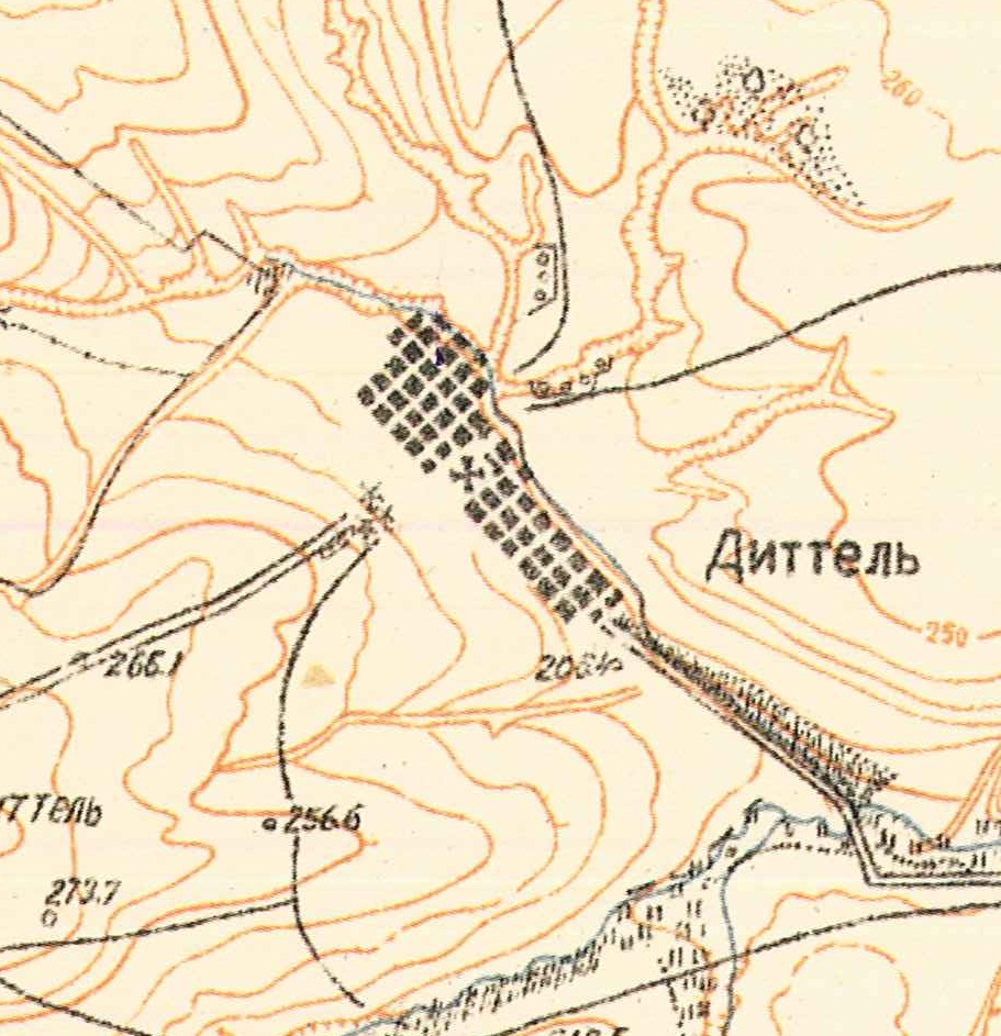
Map showing Dietel (1935).

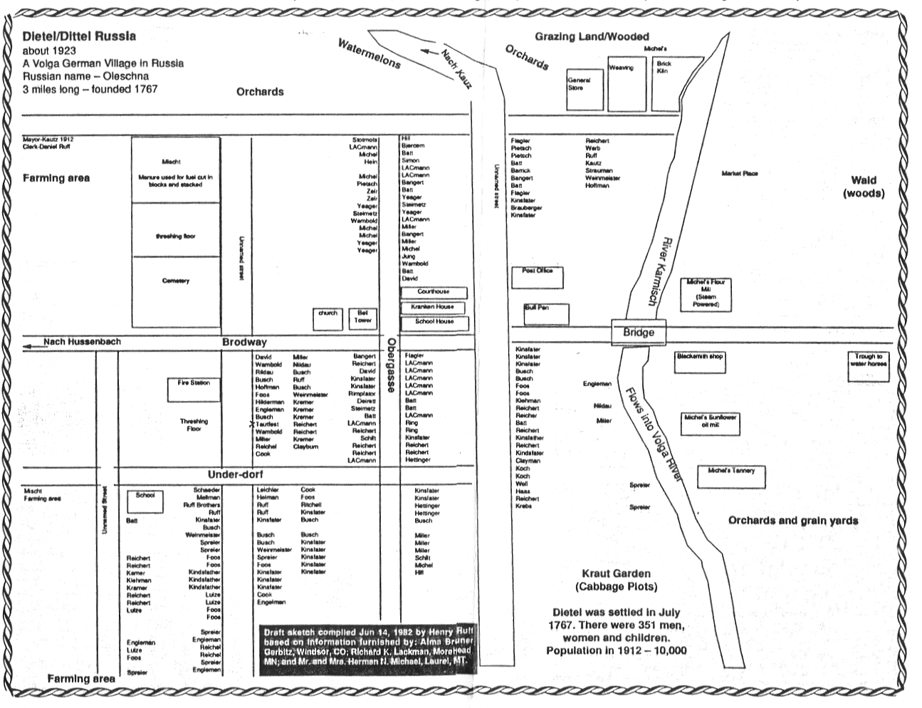
Map of Dietel (ca. 1923).
Courtesy of Reichel/Reigel Family Scrapbook.

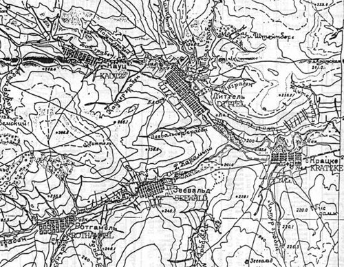
Map showing Dietel, Kautz, Kratzke, Rothammel and Sewald.