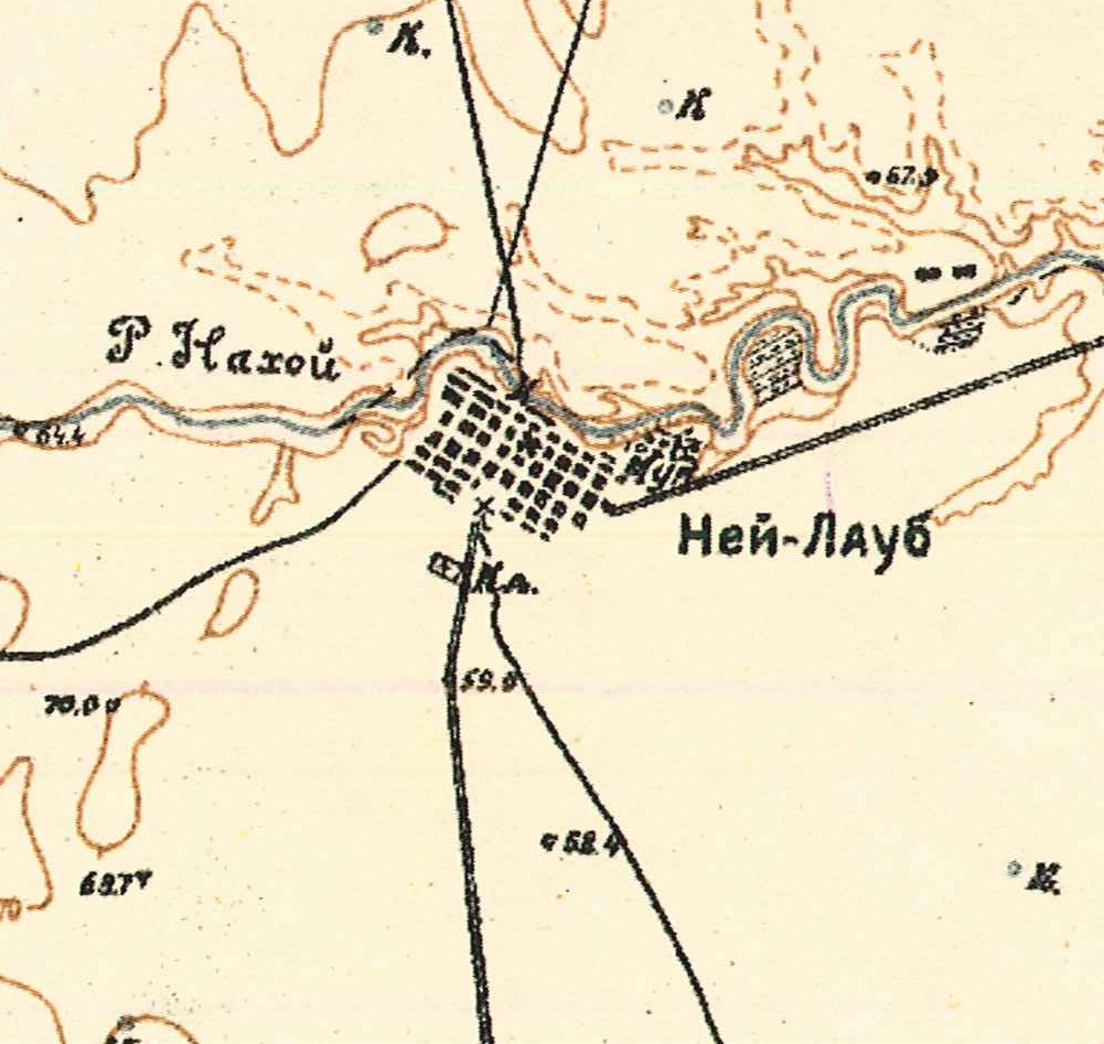
The daughter colony of Neu-Laub was founded in 1859 [1860 according to Klaus], and named after Laub, the colony from which the resettlers came. It was located on the right bank of the Nakhoi River, 445 versts from Samara and 4 versts from the nearest railway station at Nakhoi.
By 1910, there were in the colony a Lutheran Church, a school, a brick factory, and four windmills.
The congregation in Neu-Laub was part of the Lutheran parish headquartered in Weizenfeld. By 1910, there was a church building in Neu-Laub.
|
Year
|
Households
|
Population
|
||
|---|---|---|---|---|
|
Total
|
Male
|
Female
|
||
| 1859 |
|
|
|
|
| 1883 |
|
1,062
|
|
|
| 1889 |
|
1,191
|
|
|
| 1894 |
|
|
|
|
| 1897 |
|
1,434
|
715
|
719
|
| 1905 |
|
1,857
|
|
|
| 1910 |
278
|
2,261
|
1,067
|
1,194
|
| 1920 |
341*
|
2,293
|
|
|
| 1922 |
|
1,824
|
|
|
| 1923 |
|
1,898
|
|
|
| 1926** |
380
|
1,928
|
906
|
1,022
|
| 1931 |
|
2,061***
|
|
|
*Of which 340 households were German.
**Of which 374 households were German (1,910 total: 896 male & 1,014 female).
***Of whom 2,028 were German.
Neu-Laub (wolgadeutsche.net) - in Russian
- Diesendorf, V.F. Die Deutschen Russlands : Siedlungen und Siedlungsgebiete : Lexicon. Moscow, 2006.
- Dietz, Jacob E. History of the Volga German Colonists (Lincoln, NE: American Historical Society of Germans from Russia, 2005): 216, 221.
- Herdt, Karl. Die Namengebung zweier Woldadeutscher Dörfer, Alexanderdorf und Höh (Alexander-Höh): am Nachoistrom gelegen sowie Episoden aus dem damaligen Bauernleben und Skizzen aus der Steppentierwelt (Espelkamp: K. Herdt, 1983): 14.
- Klaus, A.A. Our Colonies. Saint Petersburg, Russia, 1869.
- Preliminary Results of the Soviet Census of 1926 on the Volga German Autonomous Soviet Socialist Republic (Pokrovsk, 1927): 28-83.
- "Settlements in the 1897 Census." Journal of the American Historical Society of Germans from Russia (Winter, 1990): 17.
- 1862 Neu-Laub Census
51.2, 46.65
Migrated From
Immigration Locations

Map showing Neu-Laub (1935).

Map of Colonies along the Nachoi River (1860) also showing Neu-Laub.
Source: Die Namengebung zweier Wolgadeutscher Dörfer, 1983 (p.14).