Laub was founded on 12 July 1767 by colonists who had been recruited by LeRoi & Pictet. There were 68 families who came from Darmstadt, Mecklenburg, Denmark, and Württemberg. It was named in honor of its first leader, Johann Heinrich Laub.
Laub was plundered in 1774 by the raids of Pugachev and his followers.
Today, what remains of the former Volga German colony of Laub is known as Chkalovskoye.
The congregation in Laub was part of the Warenburg Lutheran Parish which had been established in 1770. In 1909, the congregations in Laub and Dinkel separated from the Warenburg Parish and formed the Tarlyk Parish.
The Warenburg Parish Chronicles researched by Richard Kissling reveal that there was a church in Laub that burned down in 1876 when struck by lightning. A new Bethaus (prayerhouse) was constructed a few years later which served as the school during the week and was used for worship on the weekend.
The congregation in Laub was served by the following pastors:
- 1785-1788 Friedrich Konrad Strengel
- 1797-1825 Bernhard Wilhelm Litfass
- 1826-1833 Friedrich August Wilhelm Schrötter
- 1834-1883 Franz Karl Hölz
- 1891-1891 Karl Julius Hölz
- 1883-1909 Karl Leopold Hölz
- 1909-1918 Eduard Seib
- 1909-1912 Andreas Gorne
- 1929-1931 Herbert Julius Günther
|
Year
|
Households
|
Population
|
||
|---|---|---|---|---|
|
Total
|
Male
|
Female
|
||
| 1767 |
68
|
201
|
|
|
| 1769 |
61
|
193
|
106
|
87
|
| 1773 |
56
|
219
|
116
|
103
|
| 1788 |
52
|
271
|
138
|
133
|
| 1798 |
65
|
369
|
186
|
183
|
| 1816 |
73
|
533
|
278
|
255
|
| 1834 |
109
|
927
|
458
|
469
|
| 1850 |
180
|
1,536
|
751
|
785
|
| 1857 |
201
|
1,771
|
904
|
867
|
| 1859 |
158
|
1,811
|
914
|
897
|
| 1888 |
290
|
2,105
|
1,090
|
1,015
|
| 1897 |
299
|
2,252*
|
1,126
|
1,126
|
| 1904 |
|
3,143 | ||
| 1908 |
|
3,526 |
1,808
|
1,718
|
| 1910 |
300
|
3,750
|
1,938
|
1,812
|
| 1912 |
|
3,821
|
|
|
| 1920 |
374
|
2,948
|
|
|
| 1922 |
|
1,849
|
|
|
| 1923 |
|
1,857
|
|
|
| 1926** |
373
|
1,884
|
894
|
990
|
| 1931 |
|
2,460***
|
|
|
*Of whom 2,230 were German.
**Of whom 1,775 were German (368 households: 889 male & 986 female).
***Of whom 2,440 were German.
- Laub (wolgadeutsche.net) [in Russian]
- Beratz, Gottieb. The German colonies on the Lower Volga, their origin and early development: a memorial for the 150th anniversary of the arrival of the first German settlers on the Volga, 29 June 1764. Translated by Adam Giesinger (Lincoln, NE: American Historical Society of Germans from Russia, 1991): 351.
- Diesendorf, V.F. Die Deutschen Russlands : Siedlungen und Siedlungsgebiete : Lexicon. Moscow, 2006.
- Orlov, Gregorii. Report of Conditions of Settlements on the Volga to Catherine II, 14 February 1769.
- Pallas, P.S. Reise durch verschiedene Provinzen des Russischen Reichs. Theil 3,2, Reise aus Sibirien zurueck an die Wolga im 1773sten Jahr (St. Petersburg: Kaiserl. Academie der Wissenschaften, 1776): 609.
- Pleve, Igor R. The German Colonies on the Volga: The Second Half of the Eighteenth Century, translated by Richard Rye (Lincoln, NE: American Historical Society of Germans from Russia, 2001): 319.
- Preliminary Results of the Soviet Census of 1926 on the Volga German Autonomous Soviet Socialist Republic (Pokrovsk, 1927): 28-83.
- Schnurr, Joseph. Die Kirchen und das religiöse Leben der Russlanddeutschen – Evangelischer Teil (Stuttgart: AER Verlag Landsmannschaft der Deutschen aus Rußland, 1978): 348.
- "Settlements in the 1897 Census." Journal of the American Historical Society of Germans from Russia (Winter, 1990): 17.
51.0315, 46.072667
Migrated From
Immigration Locations
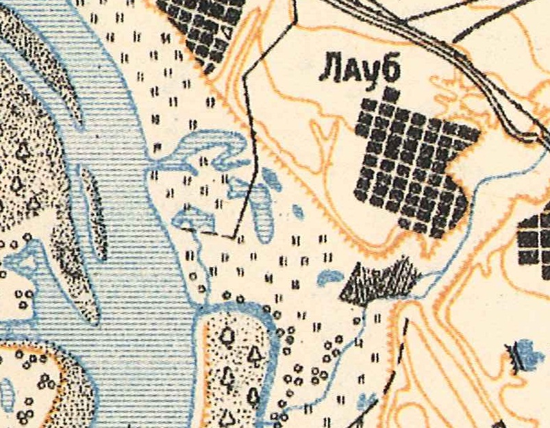
Map showing Laub (1935).
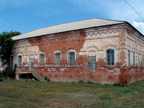
Former Laub church (August 2003), identified by the current villagers, who said the top of the church (steeple?) had been cut off. Based upon the shape and style of this building, it is more likely that it is the former school. It is now being used as a grainary.
Source: Sharon White.
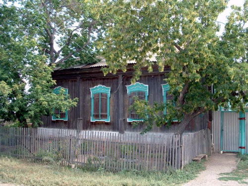
German house in Laub (August 2003).
Source: Sharon White.