The daughter colony of Friedenfeld was founded in 1855 by colonists from Merkel, Dietel, Grimm, and Bauer.
Following the anti-German era of World War I, the colony was renamed as Biryuchye.
Today, the former Volga German settlement of Friedenfeld is known as Komsomolskoye.
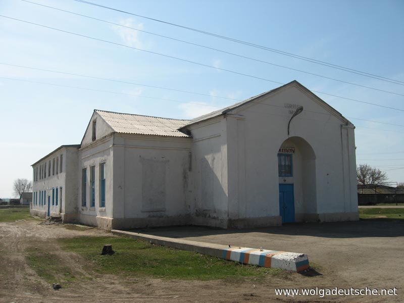
Friedenfeld was a Lutheran colony. There was a Bethaus (Prayer House) located in Friedenfeld that served as both a school and worship facility for the colony.
|
Year
|
Households
|
Population
|
||
|---|---|---|---|---|
|
Total
|
Male
|
Female
|
||
| 1857 |
|
|
|
|
| 1859 |
|
253
|
|
|
| 1889 |
|
1,217
|
|
|
| 1897 |
|
1,591*
|
804
|
787
|
| 1905 |
|
2,568
|
|
|
| 1910 |
236
|
2,891
|
1,477
|
1,414
|
| 1920 |
333
|
2,524
|
|
|
| 1922 |
|
1,517
|
|
|
| 1926** |
348
|
1,849
|
872
|
977
|
| 1931 |
|
2,200***
|
|
|
| 1939 |
|
2,614
|
|
|
*Of whom 1,571 were German.
**Of whom 1,829 (863 male & 966 female) were German living in 337 households.
***Of whom 2,191 were German.
- Friedenfeld (wolgadeutsche.net) in Russian
- Diesendorf, V.F. Die Deutschen Russlands : Siedlungen und Siedlungsgebiete : Lexicon. Moscow, 2006.
- Dietz, Jacob E. History of the Volga German Colonists (Lincoln, NE: American Historical Society of Germans from Russia, 2005): 218.
- Klaus, A. Our Colony [in Russian] (St. Petersburg, 1869): II:16.
- List of Populated Areas of the Samara Province [in Russian] (Samara, 1910): 350.
- Preliminary Results of the All-Union Census of 1926 and ASSR Volga Germans (Pokrovsk, 1927): 28-83.
- "Settlements in the 1897 Census." Journal of the American Historical Society of Germans from Russia (Winter, 1990): 17.
50.783167, 47.044
Migrated From
Immigration Locations

Map showing Friedenfeld (1935).

School for dyeing & weaving (Faerberei und Webereischule) in Friedenfeld (1902).
Source: Saratov Regional Museum via wolgadeutsche.net

Former Bethaus (Prayer House) in Friedenfeld (2009).
Source: wolgadeutsche.net