Konstantinovka was founded on the banks of the Yeruslan River in 1859 by colonists resettling from the colonies of Schilling, Jost, Merkel, Dönhof, Kutter, and Moor.
Konstantinovia is located directly across the Yeruslan River from the Russian town of Logniovka.
Today, what remains of the former Volga German settlement of Konstantinovka is still known by the name of Konstantinovka.
The original colonists of Konstantinovka were Lutherans. A new church building was constructed in Konstantinovka in 1906.
|
Year
|
Households
|
Population
|
||
|---|---|---|---|---|
|
Total
|
Male
|
Female
|
||
| 1859 |
|
211
|
|
|
| 1886 |
|
|
|
|
| 1889 |
|
667
|
|
|
| 1894 |
|
|
|
|
| 1897 |
|
822*
|
405
|
417
|
| 1905 |
|
1,505
|
|
|
| 1910 |
143
|
1,905
|
964
|
941
|
| 1912 |
|
1,800
|
|
|
| 1920 |
150**
|
1,076
|
|
|
| 1922 |
|
739
|
|
|
| 1923 |
|
830
|
|
|
| 1926*** |
187
|
941
|
443
|
498
|
| 1931 |
|
1,034****
|
|
|
*Of whom 807 were German.
**Of which 145 households were German.
***Of whom 937 (439 male & 498 female) were German living in 183 households.
****Of whom 1,000 were German.
- How Many Schillings Are There? (Gary Martens)
- Schilling (wolgadeutsche.net) in Russian
- Diesendorf, V.F. Die Deutschen Russlands : Siedlungen und Siedlungsgebiete : Lexicon. Moscow, 2006.
- Dietz, Jacob E. History of the Volga German Colonists (Lincoln, NE: American Historical Society of Germans from Russia, 2005): 220.
- Klaus, A.A. Our Colonies. Saint Petersburg, Russia, 1869. [in Russian]
- Koch, Fred C. The Volga Germans: In Russia and the Americas, from 1763 to the Present (University Park: Pennsylvania State University Press, 1977): 312.
- Map of the collectives of the Volga German Republic (1938).
- "Settlements in the 1897 Census." Journal of the American Historical Society of Germans from Russia (Winter, 1990): 16.
50.990667, 47.079333
Migrated From
Immigration Locations

Map showing Konstantinovka (1935).

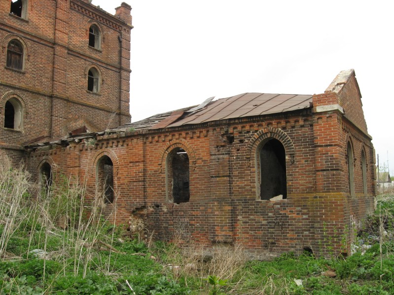
Ruins of the steam mill in Konstantinovka.
Source: Vladimir Kakorin.

Lutheran Church in Konstantinovka, built in 1906. Source: wolgadeutsche.net