Jost was founded on 5 July 1767 by 73 colonists families recruited by LeRoi & Pictet from Saxony, Prussia, Hesse-Darmstadt, and Brandenburg.
The colony was named after Johann Gottfried Jost, its first leader.
The colony was plundered during the raids of Pugachev in 1774.
In 1865, 266 people from Jost resettled to the Caucases.
During the famine of 1921, 141 people perished.
A new school was construted in Jost in 1926.
All of the Volga German inhabitants of Jost were deported to Siberia and Kazakhstan in 1941.
The former Volga German colony of Jost no longer exists, but its streets are still visible from satellite images.
The congregation in Jost was part of the Warenburg Lutheran Parish which had been established in 1770.
A new church building was constructed in Jost in 1859.
The congregation in Jost was served by the following pastors:
1785-1788 Friedrich Konrad Strengel
1797-1825 Bernhard Wilhelm Litfass
|
Year
|
Households
|
Population
|
||
|---|---|---|---|---|
|
Total
|
Male
|
Female
|
||
| 1767 |
87
|
232
|
|
|
| 1769 |
73
|
238
|
126
|
112
|
| 1773 |
66
|
219
|
121
|
98
|
| 1788 |
|
154
|
|
|
| 1798 |
54
|
264
|
|
|
| 1816 |
|
343
|
|
|
| 1834 |
72
|
548
|
269
|
279
|
| 1850 |
93
|
937
|
459
|
478
|
| 1857 |
105
|
1,082
|
528
|
554
|
| 1859 |
|
1,122
|
|
|
| 1886 |
|
|
|
|
| 1891 |
|
|
|
|
| 1894 |
|
|
|
|
| 1897 |
|
1,399
|
726
|
673
|
| 1904 |
|
2,200
|
|
|
| 1910 |
|
2,207
|
|
|
| 1912 |
|
2,526
|
|
|
| 1920 |
231*
|
1,826
|
|
|
| 1922 |
|
1,400
|
|
|
| 1926** |
228
|
1,356
|
662
|
694
|
| 1931 |
|
1,658
|
|
|
*Of which 229 households were German.
**Of whom 1,351 were German (226 households: 659 male & 692 female).
- Jost (wolgadeutsche.net) [in Russian]
- Willkommen nach Jost (Beth Davenport)
- Beratz, Gottieb. The German colonies on the Lower Volga, their origin and early development: a memorial for the 150th anniversary of the arrival of the first German settlers on the Volga, 29 June 1764. Translated by Adam Giesinger (Lincoln, NE: American Historical Society of Germans from Russia, 1991): 350.
- Diesendorf, V.F. Die Deutschen Russlands : Siedlungen und Siedlungsgebiete : Lexicon. Moscow, 2006.
- Koch, Fred C. The Volga Germans: In Russia and the Americas, from 1763 to the Present (University Park: Pennsylvania State University Press, 1977): 308.
- Orlov, Gregorii. Report of Conditions of Settlements on the Volga to Catherine II, 14 February 1769.
- Pallas, P.S. Reise durch verschiedene Provinzen des Russischen Reichs. Theil 3,2, Reise aus Sibirien zurueck an die Wolga im 1773sten Jahr (St. Petersburg: Kaiserl. Academie der Wissenschaften, 1776): 609, 622.
- Pleve, Igor R. The German Colonies on the Volga: The Second Half of the Eighteenth Century, translated by Richard Rye (Lincoln, NE: American Historical Society of Germans from Russia, 2001): 319.
- Preliminary Results of the Soviet Census of 1926 on the Volga German Autonomous Soviet Socialist Republic (Pokrovsk, 1927): 28-83.
- "Settlements in the 1897 Census." Journal of the American Historical Society of Germans from Russia (Winter, 1990): 17.
1767 Census
1798 Census
1834 Census
1850 Census
1857 Census
51.046333, 46.045167
Migrated From
Immigration Locations
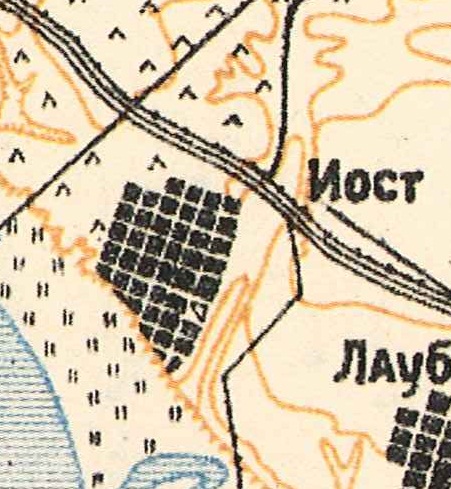
Map showing Jost (1935).
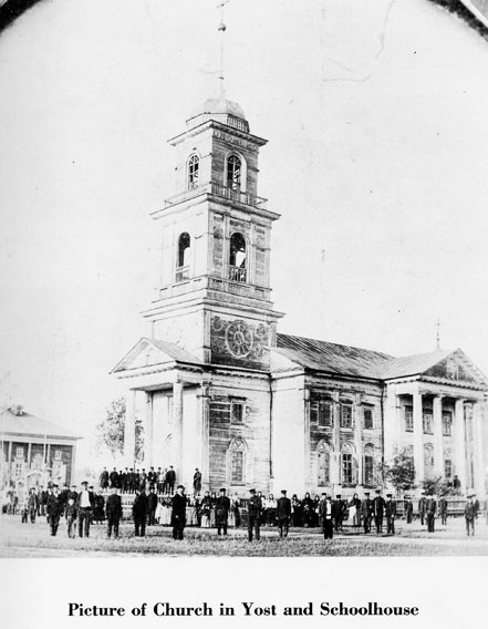
The Lutheran Church in Jost. The school is visible in the background, to the left.
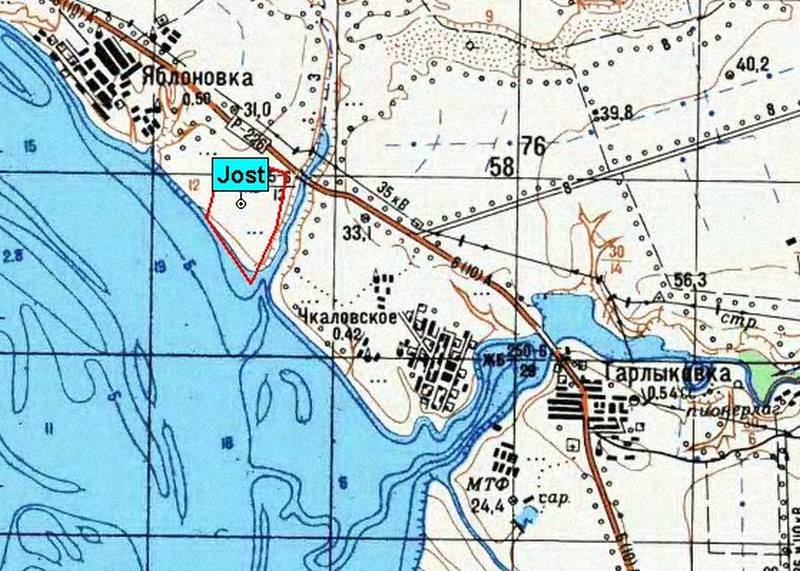
Map showing the former location of Jost.
Source: Vladimir Kakorin.
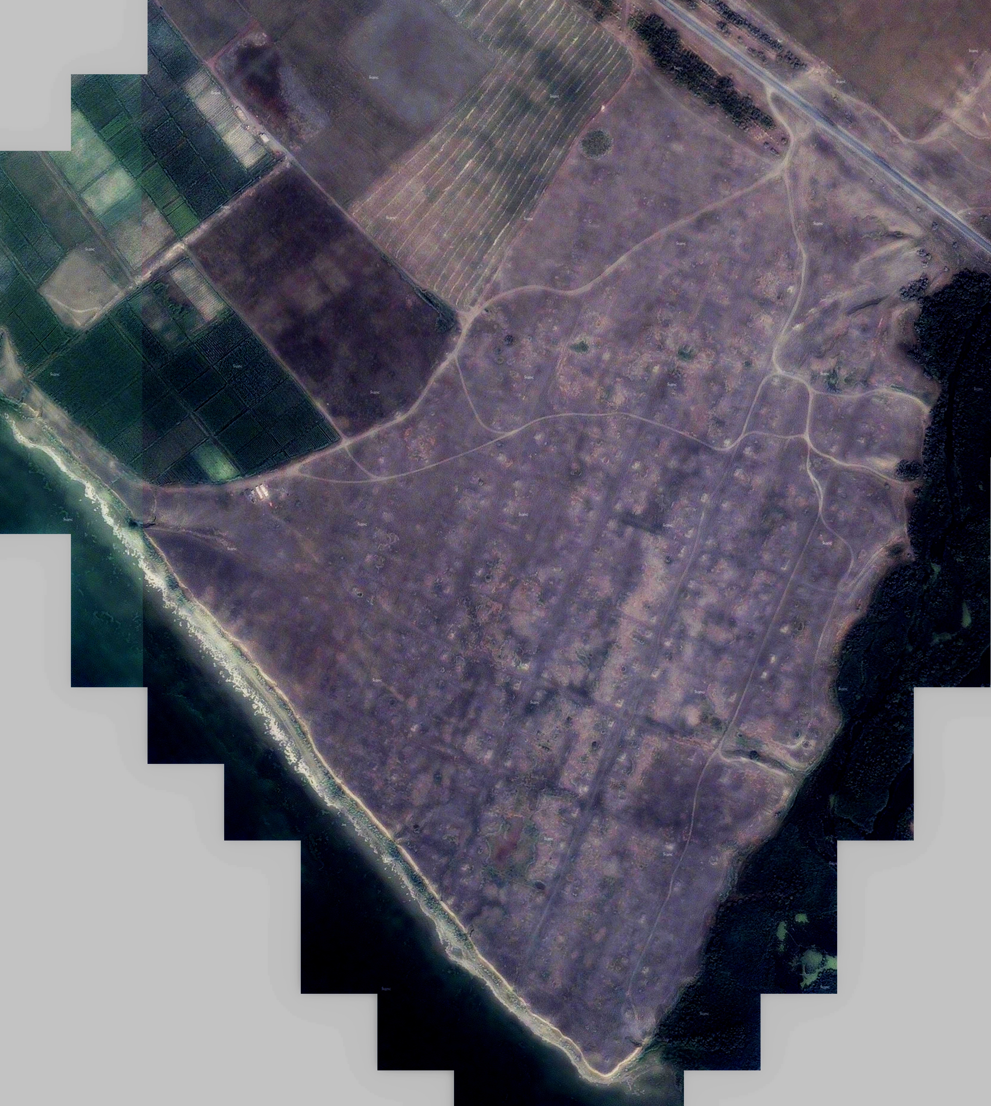
Satellite image showing the location of the former colony of Jost.
Source: Vladimir Kakorin.
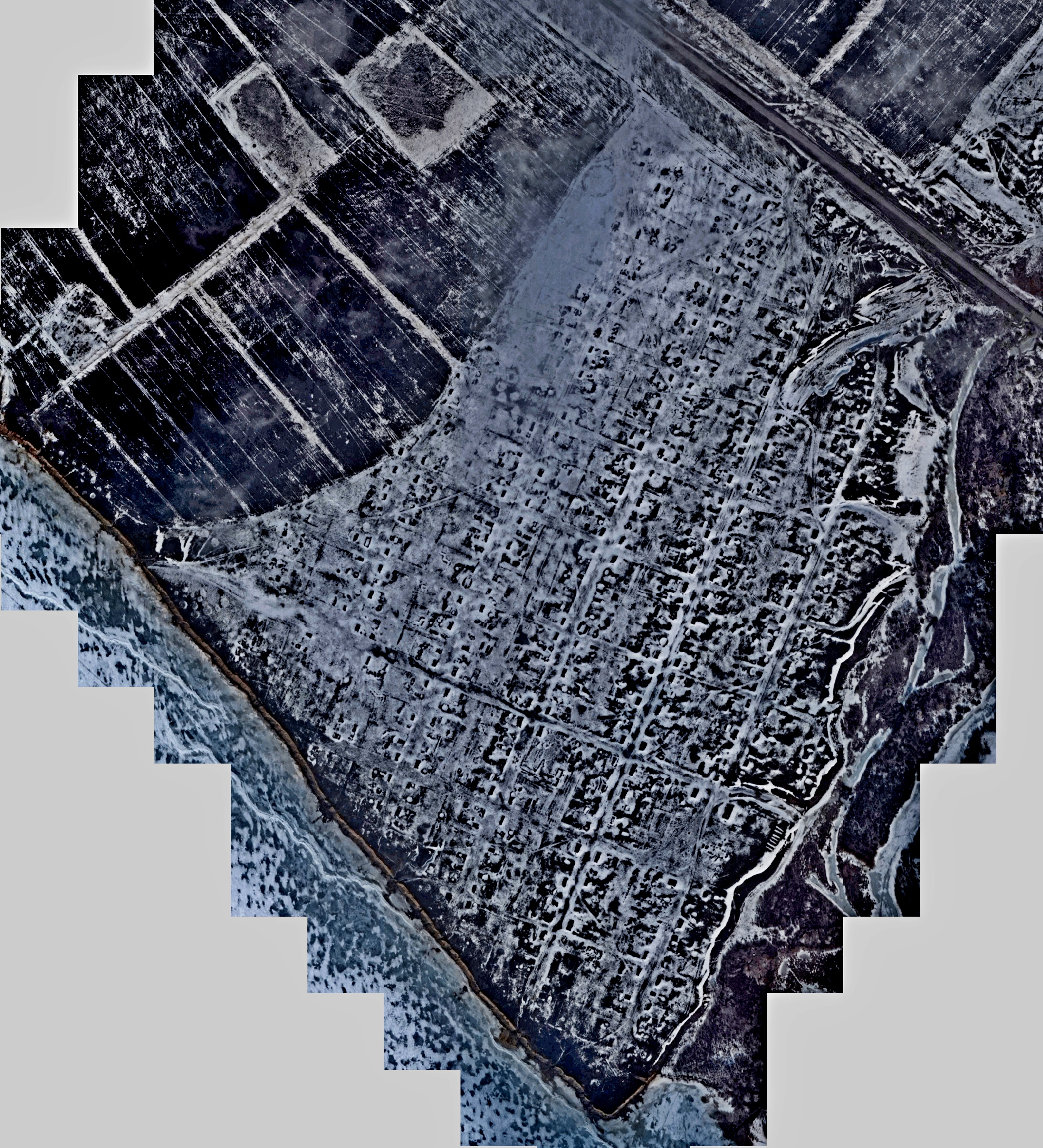
Satellite image showing the location of the former colony of Jost during the winter.
Source: Vladimir Kakorin.