Kautz was founded on 20 May 1767 by colonists recruited by Baron de Boffe. There were 28 founding families, all of whom came from the Pfalz. The colony was named after its first Vorsteher (mayor), Georg Jakob Kautz. By decree on 26 February 1768, the colony received its official Russian name of Vershinka.
In 1973, as part of a Soviet consolidation program for agricultural collectives, the inhabitants of the former colony of Kautz were relocated to the neighboring colony of Dietel, and all structures remaining there were removed. Today, nothing remains of the former colony of Kautz except for mounds of dirt that mark the location of former buildings and a few cellars.
Kautz was a Reformed colony. The congregation in Kautz was part of the Reformed parish headquartered in Messer. In 1820, it became part of the Lutheran parish headquartered in Dietel where there was a resident pastor.
A wooden church with a metal roof was constructed in Kautz in 1887.
The congregation in Kautz was served by the following pastors:
- 1767-1777 Aloysius Jauch
- 1778-1799 Johannes S. Janet
|
Year
|
Households
|
Population
|
||
|---|---|---|---|---|
|
Total
|
Male
|
Female
|
||
| 1767 |
|
107
|
|
|
| 1769 |
28
|
110
|
61
|
49
|
| 1773 |
30
|
141
|
74
|
67
|
| 1788 |
28
|
179
|
98
|
82
|
| 1798 |
36
|
223
|
119
|
104
|
| 1816 |
53
|
392
|
185
|
207
|
| 1834 |
86
|
672
|
343
|
329
|
| 1850 |
87
|
1,007
|
491
|
516
|
| 1857 |
127
|
1,316
|
647
|
669
|
| 1862 |
101
|
1,360
|
685
|
675
|
| 1886 |
180
|
1,428
|
722
|
706
|
| 1891 |
166
|
1,757
|
863
|
894
|
| 1894 |
180
|
2,089
|
1,011
|
1,078
|
| 1897 |
|
1,583*
|
769
|
814
|
| 1904 |
|
|
|
|
| 1911 |
|
1,559
|
|
|
| 1912 |
|
2,800
|
|
|
| 1920 |
224**
|
1,695
|
|
|
| 1922 |
|
1,511
|
|
|
| 1926*** |
244
|
1,657
|
811
|
846
|
| 1931 |
|
1,790
|
|
|
*Of whom 1,556 were German.
**Of which 221 households were German.
***Of whom 1,655 were German (242 households: 809 male & 846 female).
Kautz (wolgadeutsche.net) in Russian
Unsere Leute von Kautz (D. Michael Frank)
- Beratz, Gottieb. The German colonies on the Lower Volga, their origin and early development: a memorial for the 150th anniversary of the arrival of the first German settlers on the Volga, 29 June 1764. Translated by Adam Giesinger (Lincoln, NE: American Historical Society of Germans from Russia, 1991): 350.
- Diesendorf, V.F. Die Deutschen Russlands : Siedlungen und Siedlungsgebiete : Lexicon. Moscow, 2006.
- Erbes, Johannes. Deutsche Volkszeitung (23 August 1906).
- Mink, A.N. Historical and Geographical Dictionary of the Saratov Province [in Russian] (Saratov, Russia, 1898): 120-122.
- Orlov, Gregorii. Report of Conditions of Settlements on the Volga to Catherine II, 14 February 1769.
- Pallas, P.S. Reise durch verschiedene Provinzen des Russischen Reichs. Theil 3,2, Reise aus Sibirien zurueck an die Wolga im 1773sten Jahr (St. Petersburg: Kaiserl. Academie der Wissenschaften, 1776): 622.
- Pleve, Igor R. The German Colonies on the Volga: The Second Half of the Eighteenth Century, translated by Richard Rye (Lincoln, NE: American Historical Society of Germans from Russia, 2001): 319.
- Preliminary Results of the Soviet Census of 1926 on the Volga German Autonomous Soviet Socialist Republic (Pokrovsk, 1927): 28-83.
- "Settlements in the 1897 Census." Journal of the American Historical Society of Germans from Russia (Winter, 1990): 18.
1767 Census
1798 Census
1834 Census
1857 Census
50.909167, 45.121667
Migrated From
Immigration Locations
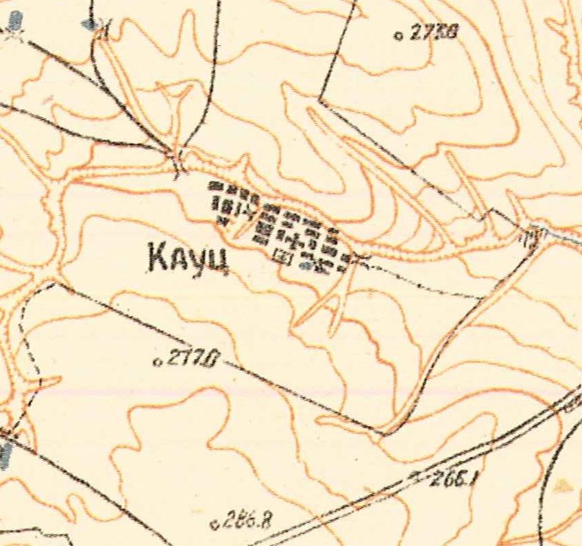
Map showning Kautz (1935).
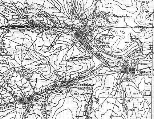
Map showing Dietel, Kautz, Kratzke, Rothammel and Sewald.
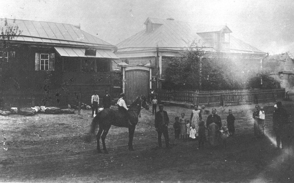
The building on the left is the Frank Store in Kautz, run by Johann Georg & Maria Barbara (Frickel) Frank, who live next door in the house on the right. The individuals in the photo are unidentified.
Source: Michael Frank.
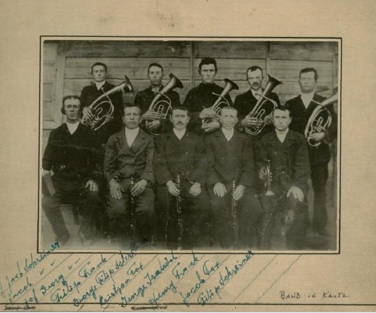
Kautz Band.
Source: Michael Frank.
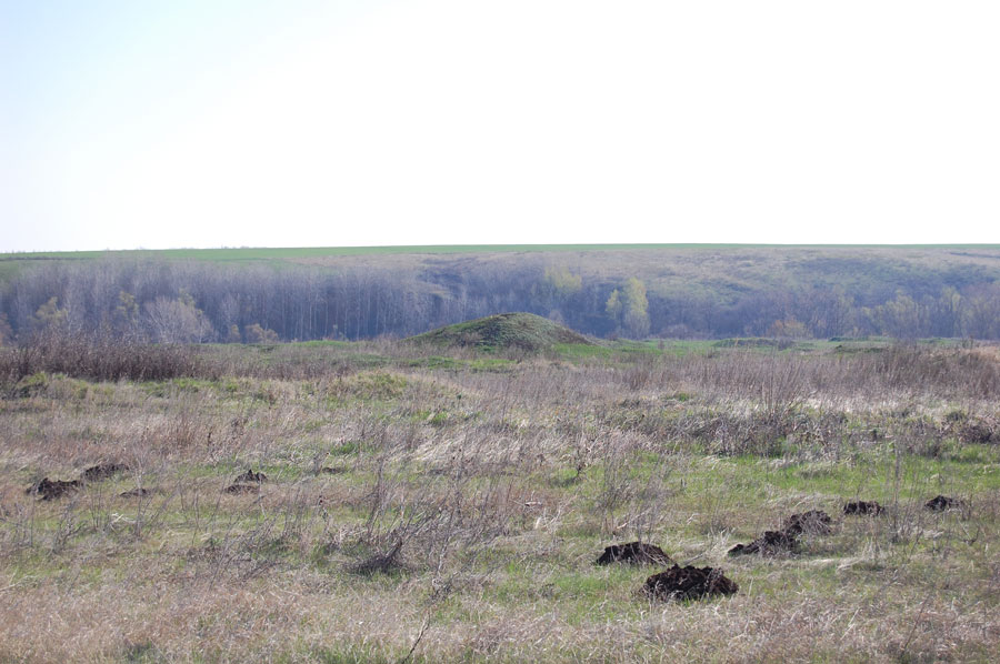
The former colony of Kautz (2009).
Source: Georgii Spak.