Erlenbach was founded in 1847 as a Lutheran colony by resettlers from Grimm, Franzosen, Dönhof, Stephan, Shcherbakovka, Galka, Holstein, Schwab, and Dobrinka.
Since 1852, there had been a parochial school in Erlenbach and in 1891, a government school was also constructed there. A new elementary school was built in 1926.
During the Soviet period, the area around Erlenbach was part of the collective farm called "Rother Stern."
Deportation from Erlenbach began on 5 September 1941 with all residents making their way to the railway station by cart. They departed the railway station the following morning aboard train number 702.
On 15 September 1941, they arrived at Maryanovka in the Omsk Oblast. Some stayed in Maryanovsk while others were distributed to neighboring villages.
Following the deportation of the Volga Germans in 1941, the settlement was renamed Remennikovo, after the merchant Remennikov who founded a farm on this location in 1828.
In 1968, the settlement was abandoned, and today, nothing remains of the former Volga German daughter colony of Erlenbach.
Erlenbach was a Lutheran daughter colony that belonged to the parish headquartered in Rosenberg. There was a wooden church in the colony, built in 1872.
|
Year
|
Households
|
Population
|
||
|---|---|---|---|---|
|
Total
|
Male
|
Female
|
||
| 1850 |
|
|
|
|
| 1857 |
58
|
593
|
309
|
284
|
| 1859 |
57
|
612
|
314
|
298
|
| 1886 |
131
|
1,092
|
562
|
530
|
| 1891 |
|
|
|
|
| 1894 |
142
|
884
|
458
|
426
|
| 1897 |
|
1,180*
|
604
|
576
|
| 1904 |
|
1,320
|
|
|
| 1911 |
|
1,525
|
|
|
| 1920 |
224**
|
1,560
|
|
|
| 1922 |
|
1,368
|
|
|
| 1926*** |
234
|
1,462
|
724
|
738
|
| 1931 |
|
1,613****
|
|
|
*Of whom 1,175 were German.
**Of which 219 households were German.
***Of whom 1,453 were German (231 households: 716 male & 737 female).
****Of whom 1,601 were German.
- Erlenbach (Wolgadeutsche.net) in Russian
- Diesendorf, V.F. Die Deutschen Russlands : Siedlungen und Siedlungsgebiete : Lexicon. Moscow, 2006.
- Dietz, Jacob E., History of the Volga German Colonists (Lincoln, NE: American Historical Society of Germans from Russia, 2005): 215.
- Koch, Fred C. The Volga Germans: In Russia and the Americas, from 1763 to the Present (University Park: Pennsylvania State University Press, 1977): 311.
- Mink, A.N. Historical and Geographical Dictionary of the Saratov Province [in Russian] (Saratov, Russia, 1898): 1399-1402.
- Preliminary Results of the Soviet Census of 1926 on the Volga German Autonomous Soviet Socialist Republic (Pokrovsk, 1927): 28-83.
- "Settlements in the 1897 Census." Journal of the American Historical Society of Germans from Russia (Winter, 1990): 19.
50.284667, 45.039
Migrated From
Immigration Locations
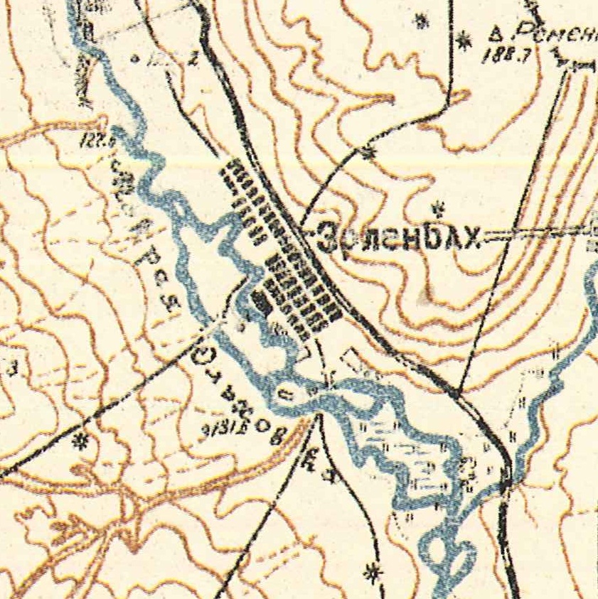
Map showing Erlenbach (1935).