Josefstal was founded in 1852 as a Roman Catholic colony on the left bank of the Sukhaya Olkhovka (Dry Olkhovka) River. It was given this name in honor of St. Joseph. The colony was intended to accommodate 56 families or 336 people. On 17 October 1852 in Josefstal there were already 34 families (206 people) living there. One of the first colonists to settle there was named Schwab, and the colony was often referred to as Schwab's Khutor.
According to the Josefstal Census of 1857, 23 families (149 people) came from Kamenka; 21 families (132 people) from Pfeifer; 16 families (111 people) from Köhler, 11 families (49 families) from Göbel, 7 families (45 people) from Hildmann, 6 families (39 people) from Husaren, 4 families (24 persons) from Leichtling, 4 families (23 people) from Schuck, 4 families (19 people) from Volmer, 1 family (6 people) from Degott, 1 family (4 people) from Marienfeld, and one family from an unknown colony. It should be noted that out of the 99 enumerated families, 15 of them (94 people) did not actually reside in the colony.
Emigration to American began in 1877 when 6 families left. In 1886 another 4 young men of military age left for America.
Since the founding of the colony, there had been a parish school in the colony, which by law should have taught all the children from 7 to 14 years. The school year started August 20 and ended June 20. The training took place each school day from 8 to 11 a.m. and from 2 to 4 p.m. In 1886, there were 87 boys and 55 girls enrolled in the school. In 1890, there were 103 boys and 87 girls. Despite the threat of a fine of 3 copeks for the missed days, many children, especially boys, did not attend school.
The parish education, however, was weak. Of the 887 residents of the colony in 1886, only 311 could hardly read printed letters, but truly literate people were very few. Dissatisfaction of the educational system in the church school, led in 1885 to the creation of a private school by several wealthy Josefstal families. There students were taught to read and write in both the Russian and German languages, the laws of God, a little geography, and 4 of the rules of arithmetic. Interest in this new school resulted in its rapid growth. There were 9 boys when the school was founded in 1886, 12 the following year, and by 1890 there were 20 pupils.
Following collectivization, the village was the headquarters for the collective farm called "Rother Virtschaftler" in 1936. Following the 1941 deportation of the Volga Germans, the village was called Skripalovo Remenikovsk in 1944, and was changed to Zhdanovsk in 1944. In 1963, the name was changed to Kotovsk.
Today, nothing remains of the former colony of Josefstal.
The congregation in Josefstal was part of the Marienfeld parish. Its first church was built in 1870 out of wood with a iron-clad roof. A new church building was constructed in Josefstal in 1904. It served the congregation there until about 1937 when it was disbanded by the government.
The congregation in Josefstal was served by the following priests:
Franz P. Rauh (1918-1923)
|
Year
|
Households
|
Population
|
||
|---|---|---|---|---|
|
Total
|
Male
|
Female
|
||
| 1852 |
34
|
206
|
|
|
| 1857 |
80
|
|
351
|
|
| 1859 |
54
|
617
|
352
|
265
|
| 1886 |
143
|
887
|
472
|
415
|
| 1890 |
|
1,147
|
603
|
544
|
| 1894 |
139
|
1,206
|
615
|
591
|
| 1897 |
|
1,158*
|
584
|
574
|
| 1905 |
|
1,206
|
|
|
| 1911 |
|
1,020
|
|
|
| 1920 |
201
|
1,418
|
|
|
| 1922 |
|
1,238
|
|
|
| 1926** |
236
|
1,379
|
654
|
725
|
| 1931 |
|
1,631
|
|
|
*Of whom 1,122 were German.
**Of whom 1,373 were German (234 households: 651 male & 722 female).
History of Josefstal (Igor Pleve) in Russian
Josefstal (wolgadeutsche.net) in Russian
Josefstal Database (Ted Gerk)
Josefstal Homepage (Ted Gerk)
Video cemetery in Josefstal, 2007 (Ted Gerk)
- Diesendorf, V.F. Die Deutschen Russlands : Siedlungen und Siedlungsgebiete : Lexicon. Moscow, 2006.
- Dreser, Alexander-Josef & Edward Gerk. Das Leben an der Wolga: Chronik der Kolonie Josefstal Kanton Erlenbach (Meschede, Germany: Alexander-Josef Dreser, 2009).
- Klaus, A. A. Our Colonies (St. Petersburg, 1869): Appendix II, p. 5.
- Koch, Fred C. The Volga Germans: In Russia and the Americas, from 1763 to the Present (University Park: Pennsylvania State University Press, 1977): 311.
- List of Populated Places of the Russian Empire - Saratov Province (St. Petersburg, 1862): 58.
- Minkh, A. N. Historical-Geographical Dictionary of the Saratov Province (Saratov, 1903): 363.
- Pleve, Igor, A History of the Colony of Josefstal.
- Preliminary Results of the Soviet Census of 1926 on the Volga German Autonomous Soviet Socialist Republic (Pokrovsk, 1927): 28-83.
- Schnurr, Joseph, Die Kirchen und das Religiöse Leben der Russlanddeutschen, Katholischer Teil (Stuttgart, 1980): 245.
- "Settlements in the 1897 Census." Journal of the American Historical Society of Germans from Russia (Winter, 1990): 18.
- 1857 Census of Josefstal (dated 14 February 1858).
50.284333, 45.084833
Migrated From
Immigration Locations
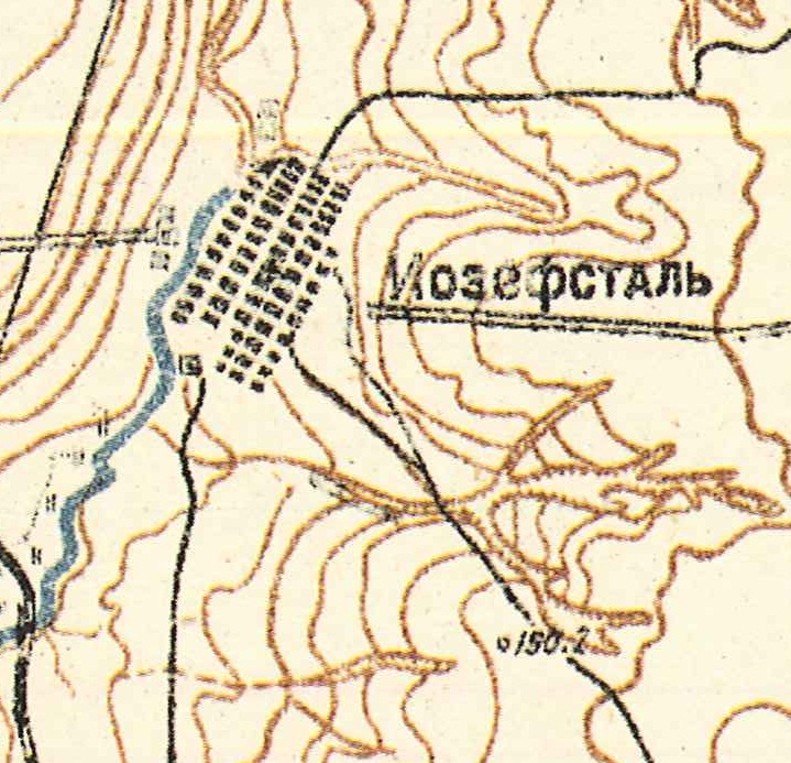
Map showing Josefstal (1935).

Architectural rendering of the Catholic Church in Josefstal, built in 1904.
Source: GASO Fond 656 Opis 1 Nr. 916 via Ted Gerk & Jorge Bohn.
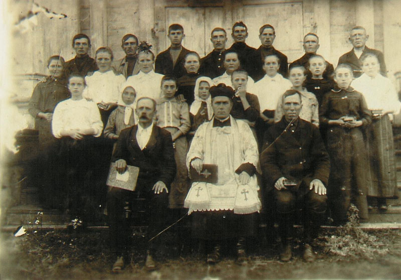
Church Choir in Josefstal (ca.1927)
Father Johannes Falkenstein (center)
Photo courtesy of Barbara Schaab via Ted Gerk.