Lauwe was founded on 19 August 1767 by colonists recruited by LeRoi & Pictet. The original 41 families were from Nüremberg, Baden, Darmstadt, Neu-Isenburg, the Palatinate (Pfalz), the Rheinland, Saxony, and Brandenburg. Lauwe was named in honor of its first leader, Johann Lauwe.
Lauwe was one of the villages that was looted during the 1774 uprising by Pugachev.
During the famine in 1921, there were 94 people who died in Lauwe.
On 5 June 1942, the name of the Volga German former colony of Lauwe was changed to Yablonovka, and this is the name used today by those who live in what little remains of the former colony.
Most of the original founders of Lauwe were Lutheran; there were a few Roman Catholic colonists.
Until 1821, the Lutheran congregation in Lauwe was part of the Warenburg parish. In 1821, it became part of the parish headquartered in Kukkus where the pastor lived.
During the early decades, there was a Bethaus (prayer house) in the colony that served as both a school and a church.
In 1829, a church building was constructed out of wood. In 1893, a new church was built in the Kontor style. Over time, there was also a Catholic prayer house and a Baptist prayer house located in the colony.
According to the Central Executive Committee of the Autonomous Soviet Socialist Republic of the Volga Germans, the church in Lauwe was dismantled in 1931 and its materials used for the construction of houses. Worship services were then held in a wooden prayer house, but that was closed by a decree of the Presidium of the Central Executive Committee of the Autonomous Soviet Socialist Republic of the Volga Germans at the end of 1934.
|
Year
|
Households
|
Population
|
||
|---|---|---|---|---|
|
Total
|
Male
|
Female
|
||
| 1767 |
58
|
169
|
|
|
| 1769 |
41
|
152
|
76
|
76
|
| 1773 |
47
|
179
|
90
|
89
|
| 1788 |
40
|
165
|
86
|
79
|
| 1798 |
43
|
244
|
140
|
104
|
| 1816 |
51
|
540
|
256
|
284
|
| 1834 |
69
|
600
|
297
|
303
|
| 1850 |
103
|
927
|
456
|
471
|
| 1857 |
116
|
1,059
|
523
|
536
|
| 1859 |
105
|
1,103
|
558
|
545
|
| 1888 |
211
|
1,548
|
790
|
758
|
| 1891 |
|
|
|
|
| 1897 |
|
1,695*
|
845
|
850
|
| 1904 |
|
2,412 | ||
| 1908 |
221
|
2,592 |
1,304
|
1,288
|
| 1910 |
204
|
2,588
|
1,279
|
1,309
|
| 1912 |
|
2,680
|
|
|
| 1920 |
256**
|
1,968
|
|
|
| 1922 |
|
1,730
|
|
|
| 1926*** |
293
|
1,639
|
770
|
869
|
| 1931 |
|
1,850****
|
|
|
*Of whom 1,654 were German.
**Of which 255 households were German.
***Of whom 1,607 were German (286 households: 755 male & 852 female).
****Of whom 1,818 were German.
- Descendants of Goeringer (George Overly)
- Die Lauwe Lampe (Bernice Madden)
- Lauwe (wolgadeutsche.net) [in Russian]
- Lauwe A German Village on the Volga River (Ray Heinle)
- Markus Ancestry (Debra Markus Earl)
- Yablonovka (Wikipedia)
- Beratz, Gottieb. The German colonies on the Lower Volga, their origin and early development: a memorial for the 150th anniversary of the arrival of the first German settlers on the Volga, 29 June 1764. Translated by Adam Giesinger (Lincoln, NE: American Historical Society of Germans from Russia, 1991): 351.
- Diesendorf, V.F. Die Deutschen Russlands : Siedlungen und Siedlungsgebiete : Lexicon. Moscow, 2006.
- Orlov, Gregorii. Report of Conditions of Settlements on the Volga to Catherine II, 14 February 1769.
- Pallas, P.S. Reise durch verschiedene Provinzen des Russischen Reichs. Theil 3,2, Reise aus Sibirien zurueck an die Wolga im 1773sten Jahr (St. Petersburg: Kaiserl. Academie der Wissenschaften, 1776): 609.
- Preliminary Results of the Soviet Census of 1926 on the Volga German Autonomous Soviet Socialist Republic (Pokrovsk, 1927): 28-83.
- "Settlements in the 1897 Census." Journal of the American Historical Society of Germans from Russia (Winter, 1990): 18.
51.057833, 46.0205
Migrated From
Immigration Locations

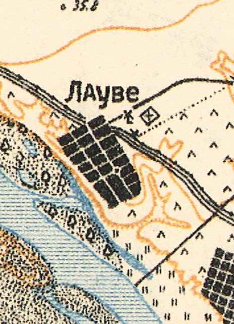
Map showning Lauwe (1935).

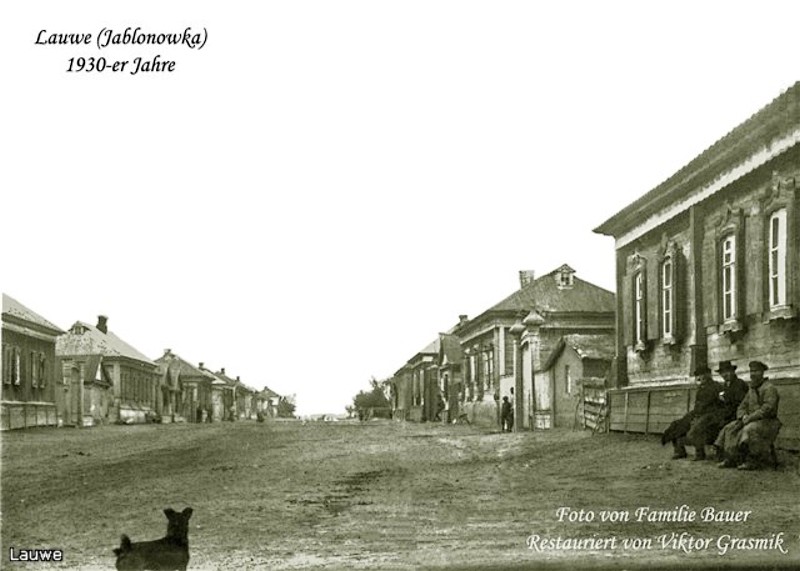
Street scene in Lauwe (1930s).
Source: Bauer Family via "Немцы Поволжья" website.

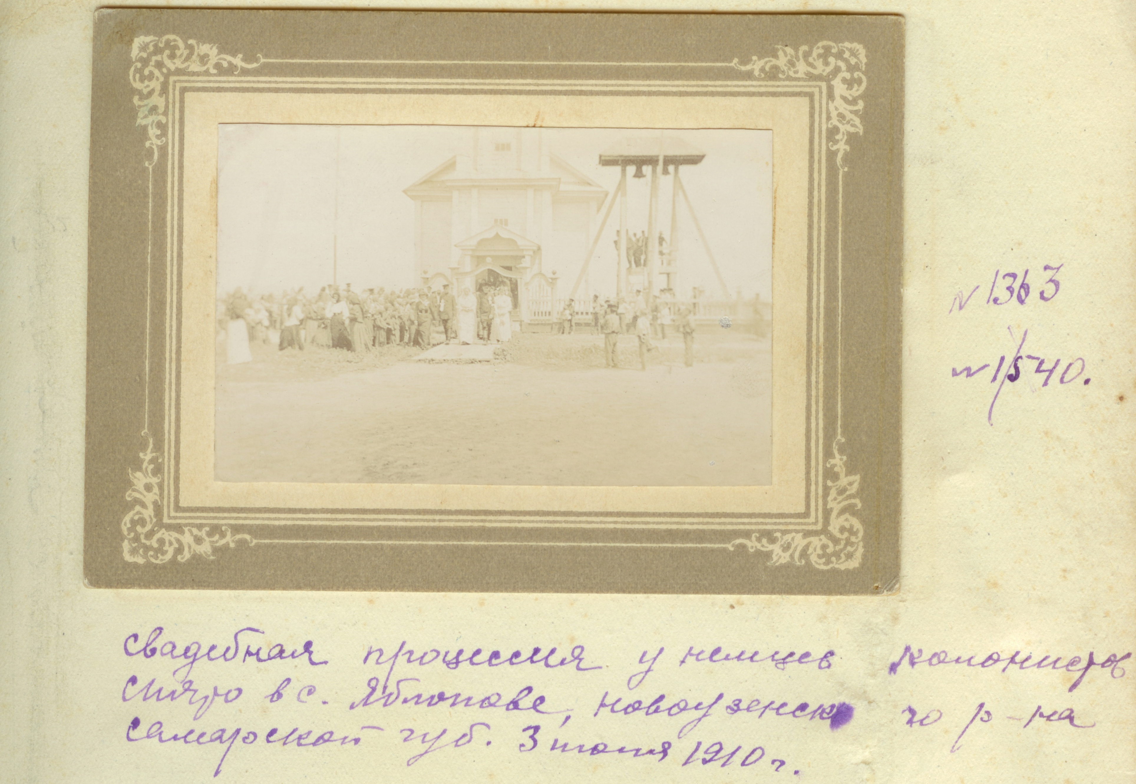
Wedding in Lauwe in 1910.
Source: unknown.