Urbach was founded on 13 July 1767 by colonists recruited by LeRoi & Pictet. The colony was named after its first mayor (Vorsteher), Johann Jakob Urbach.
Today, what remains of the former Volga German colony of Urbach is known as Furmanovka.
Originally the Lutheran congregation in Urbach was part of the Rosenheim parish which had been established in 1767.
A new church building was constructed in Urbach in 1870.
The congregation in Urbach was served by the following pastors:
- Ludwig Helm (1767-1785)
- Daniel Willi (1777-1787?)
- Laurentius Ahlbaum (1786-1788)
- Klaus Peter Lundberg (1788-1791)
- Mag. Christian Friedrich Jäger (1792-1815)
|
Year
|
Households
|
Population
|
||
|---|---|---|---|---|
|
Total
|
Male
|
Female
|
||
| 1767 |
|
187
|
|
|
| 1769 |
|
160
|
|
|
| 1773 |
48
|
187
|
92
|
95
|
| 1788 |
20
|
106
|
51
|
55
|
| 1798 |
30
|
198
|
99
|
99
|
| 1816 |
45
|
240
|
174
|
166
|
| 1834 |
73
|
625
|
321
|
304
|
| 1850 |
107
|
971
|
492
|
479
|
| 1857 |
142
|
1,230
|
628
|
602
|
| 1859 |
|
1,275
|
|
|
| 1889 |
|
1,738
|
|
|
| 1897 |
|
1,769*
|
887
|
882
|
| 1905 |
|
2,728
|
|
|
| 1910 |
340
|
2,869
|
1,413
|
1,456
|
| 1912 |
|
2,827
|
|
|
| 1920 |
341
|
2,364
|
|
|
| 1922 |
|
1,831
|
|
|
| 1926 |
353
|
1,856**
|
913
|
943
|
| 1931 |
|
2,134
|
|
|
*Of whom 1,745 were German.
**Of whom 1,841 (898 male & 943 female) were German in 351 households.
Alt-Urbach (wolgadeutsche.net) in Russian
- Beratz, Gottieb. The German colonies on the Lower Volga, their origin and early development: a memorial for the 150th anniversary of the arrival of the first German settlers on the Volga, 29 June 1764. Translated by Adam Giesinger (Lincoln, NE: American Historical Society of Germans from Russia, 1991): 353.
- Diesendorf, V.F. Die Deutschen Russlands : Siedlungen und Siedlungsgebiete : Lexicon. Moscow, 2006.
- Dietz, Jacob E. History of the Volga German Colonists. Lincoln, NE: American Historical Society of Germans from Russia, 2005.
- Herman, A. A. German Autonomy on the Volga, 1918-1941 (Saratov: Saratov University, 1994): II:375,378.
- Klaus, A.A. Our Colonies (Saint Petersburg, Russia, 1869): II:10; IV:52-53.
- List of the Populated Places of the Samara Province (Samara, Russia, 1910): 379.
- Pallas, P.S. Reise durch verschiedene Provinzen des Russischen Reichs. Theil 3,2, Reise aus Sibirien zurueck an die Wolga im 1773sten Jahr (St. Petersburg: Kaiserl. Academie der Wissenschaften, 1776): 612.
- Pleve, Igor R. The German Colonies on the Volga: The Second Half of the Eighteenth Century, translated by Richard Rye (Lincoln, NE: American Historical Society of Germans from Russia, 2001): 318.
- Preliminary Results of the Soviet Census of 1926 on the Volga German Autonomous Soviet Socialist Republic (Pokrovsk, 1927): 28-83.
- "Settlements in the 1897 Census." Journal of the American Historical Society of Germans from Russia (Winter, 1990): 16.
51.537482, 46.596419
Migrated From
Immigration Locations
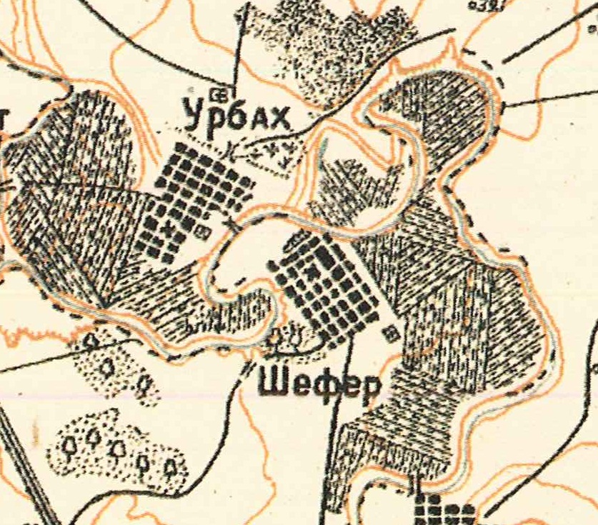
Map showing Urbach - upper left (1935).
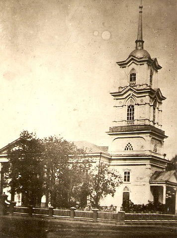
Urbach Lutheran Church (built in 1870).
Source: David & Catherine Piester.
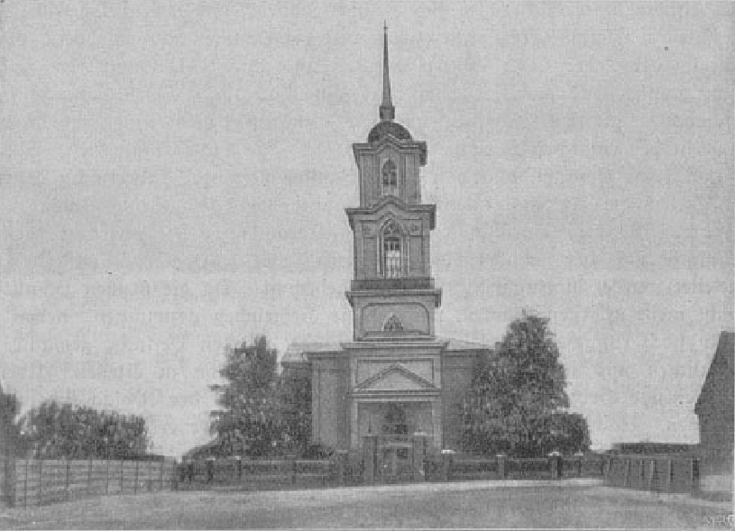
Photo of the church in Urbach.
Source: Wolgadeutsche.net