Semenovka was founded on 24 July 1767 [some sources erroneously record the founding date as 24 June 1767] by colonists who had been recruited by Catherine the Great's own agents. The 43 founding families were Roman Catholic and came from the regions of Mainz, Prussia, Fulda, and Westfalen (Westphalia).
It was also known by the German name of Röthling (the surname of one of the early leaders of the colony), but has generally been known as Semenovka after the river that flowed near the colony.
Today, what remains of the the former colony is still known as Semenovka (pronounced Semyanovka).
Semenovka was the residence of the local Catholic priest who also served neighboring colonies.
A new wooden church built in the Kontor style was constructed in 1855 in Semenovka and dedicated in 1856. After the deportation of the Volga Germans in 1941, the church was dismantled by Nazi prisoners of war at the end of the war, and the materials used in the rebuilding of Stalingrad (now called Volgograd).
The parish of Semenovka was served by the following priests:
Johannes Meier (1803-1807)
Ignatius Zacharewitsch (1807-1820)
Antony Ludwist (1821-1825)
Vincent Snarsky (1825-1837)
Romuald Kotwitsch (1827-?)
Joseph Tulzewitsch (1837-1840)
Anton Ivanov (1840-1842)
Viktoryn Eschnutowitsch (1842-?)
Georg Dechand (1873-1887)
Georg Rießling (1877)
Joseph Baumtrog (1897-1915)
Andreas Schönberger (1917-1928)
Martin Fix (1928-1930)
|
Year
|
Households
|
Population
|
||
|---|---|---|---|---|
|
Total
|
Male
|
Female
|
||
| 1767 |
43
|
144
|
76
|
68
|
| 1769 |
40
|
185
|
96
|
89
|
| 1773 |
49
|
232
|
110
|
122
|
| 1788 |
50
|
308
|
145
|
163
|
| 1798 |
64
|
407
|
202
|
205
|
| 1816 |
110
|
765
|
389
|
376
|
| 1834 |
171
|
1,444
|
756
|
688
|
| 1850 |
217
|
2,398
|
1,251
|
1,147
|
| 1857 |
239
|
2,926
|
1,515
|
1,411
|
| 1860 |
240
|
2,984
|
1,563
|
1,421
|
| 1886 |
419
|
3,349
|
1,720
|
1,629
|
| 1891 |
370
|
4,362
|
2,233
|
2,129
|
| 1894 |
386
|
4,581
|
2,345
|
2,236
|
| 1897 |
|
3,433*
|
1,727
|
1,706
|
| 1905 |
|
5,743
|
|
|
| 1910 |
|
6,002
|
|
|
| 1911 |
|
6,292
|
|
|
| 1912 |
|
6,407
|
|
|
| 1920 |
759**
|
4,862
|
|
|
| 1922 |
|
3,276
|
|
|
| 1923 |
|
3,428
|
|
|
| 1926*** |
771
|
4,120
|
1,996
|
2,124
|
| 1931 |
|
4,726
|
|
|
*Of whom 3,428 are German.
**Of which 758 households are German.
***Of whom 4,114 are German (766 households: 1,991 male & 2,123 female).
- Semenovka (wolgadeutsche.net) in Russian
- Semenovka Blogspot (Carlos Schwab & Corina Hirt)
- Semenovka, Russia (Ted Gerk)
- Beratz, Gottieb. The German colonies on the Lower Volga, their origin and early development: a memorial for the 150th anniversary of the arrival of the first German settlers on the Volga, 29 June 1764. Translated by Adam Giesinger (Lincoln, NE: American Historical Society of Germans from Russia, 1991): 353.
- Diesendorf, V.F. Die Deutschen Russlands : Siedlungen und Siedlungsgebiete : Lexicon. Moscow, 2006.
- Erbes, Johannes. Deutsche Volkszeitung (23 August 1906).
- Klaus, A.A. Our Colonies (Saint Petersbug, Russia, 1869).
- Mink, A.N. Historical and Geographical Dictionary of the Saratov Province. (Saratov, Russia, 1898): 931-934.
- Pallas, P.S. Reise durch verschiedene Provinzen des Russischen Reichs. Theil 3,2, Reise aus Sibirien zurueck an die Wolga im 1773sten Jahr (St. Petersburg: Kaiserl. Academie der Wissenschaften, 1776): 623.
- Pleve, Igor. Einwanderung in das Wolgagebiet, 1764-1767 Band 4 (Göttingen: Der Göttinger Arbeitskreis, 2008): 11, 177-189.
- Preliminary Totals of the All-Union Population Census of 1926 for the Volga German ASSR (Pokrovsk, Russia, 1927): 28-83.
- "Settlements in the 1897 Census." Journal of the American Historical Society of Germans from Russia (Winter, 1990): 19.
50.4875, 45.321944
Migrated From
Immigration Locations
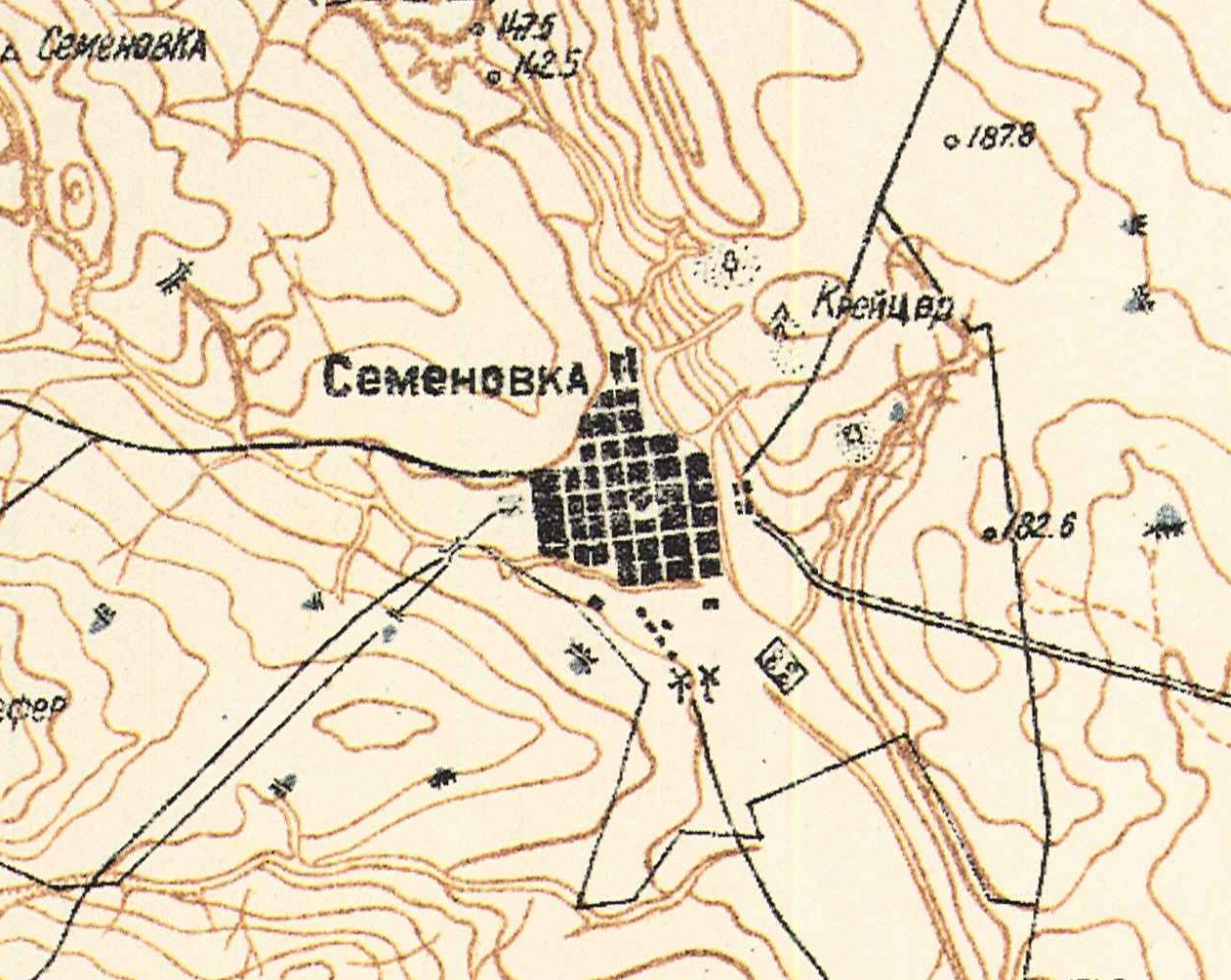
Map showing Semenovka (1935).

Semenovka Catholic Church built in 1855.
Source: Heimatbuch der Deutschen aus Rußland, 1972.
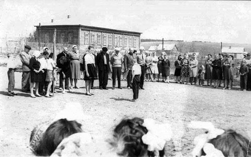
Volga German celebration in Semenovka.
Source: unknown.

Semenovka Cemetery (1992).
Source: Ted Gerk.
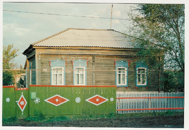
House in Semenovka (1992).
Source: Ted Gerk.