Graf was founded on 10 June 1766 by colonists recruited by LeRoi & Pictet. The colony took its name from Johannes Graf, the first mayor (Vorsteher) of the colony.
Today, nothing remains of the former colony of Graf.
The original settlers of Graf were of the Roman Catholic faith practice. An independent Roman Catholic parish with a resident priest was established in Graf in 1883.
A new church was constructed in Graf in 1886. It, like many others among the Volga German colonies, was built of wood in the Kontor Style.
The parish in Graf is known to have been served by the following priests:
- Joseph Loran (1883-1885)
- Johannes Schönfeld (1898)
- Emanuel Stang (1898-1901)
- Andreas Brungardt (?-1903)
- Alois Vondrau (1903-1905, 1910-1911)
- Gabriel Gwamaradse (1904-1905)
- Adolf Braun (1912-1914)
|
Year
|
Households
|
Population
|
||
|---|---|---|---|---|
|
Total
|
Male
|
Female
|
||
| 1767 |
48
|
141
|
|
|
| 1769 |
42
|
152
|
82
|
70
|
| 1773 |
40
|
178
|
101
|
77
|
| 1788 |
|
196
|
|
|
| 1798 |
|
253
|
|
|
| 1816 |
|
363
|
|
|
| 1834 |
|
563
|
|
|
| 1850 |
|
817
|
|
|
| 1857 |
|
|
|
|
| 1859 |
|
1,097
|
|
|
| 1883 |
|
1,374
|
|
|
| 1889 |
|
1,570
|
|
|
| 1897 |
|
1,806*
|
865
|
941
|
| 1904 |
|
|
|
|
| 1910 |
|
1,871
|
|
|
| 1912 |
|
2,009
|
|
|
| 1920 |
321**
|
2,062
|
|
|
| 1922 |
|
1,061
|
|
|
| 1926*** |
245
|
1,245
|
575
|
670
|
| 1931 |
|
1,658
|
|
|
*Of whom 1,801 were German.
**Of which 316 households were German.
***Of whom 1,241 were German (242 households: 571 male & 670 female).
Graf (Krutoyarovka), Russia (Kevin Rupp)
- Beratz, Gottieb. The German colonies on the Lower Volga, their origin and early development: a memorial for the 150th anniversary of the arrival of the first German settlers on the Volga, 29 June 1764. Translated by Adam Giesinger (Lincoln, NE: American Historical Society of Germans from Russia, 1991): 349.
- Diesendorf, V.F. Die Deutschen Russlands : Siedlungen und Siedlungsgebiete : Lexicon. Moscow, 2006.
- The German Settlements in the USSR before 1941 [in Russian] (Moscow, 2002): 100.
- Orlov, Gregorii. Report of Conditions of Settlements on the Volga to Catherine II, 14 February 1769.
- Pleve, Igor. Einwanderung in das Wolgagebiet, 1764-1767 Band 2 (Göttingen: Der Göttinger Arbeitskreis, 2001): 59-71.
- Preliminary Results of the Soviet Census of 1926 on the Volga German Autonomous Soviet Socialist Republic (Pokrovsk, 1927): 28-83.
- Schnurr, Joseph. Die Kirchen und das religiöse Leben der Russlanddeutschen - Katholischer Teil (Stuttgart: Selbstverlag Joseph Schnurr, 1972): 127.
- "Settlements in the 1897 Census." Journal of the American Historical Society of Germans from Russia (Winter, 1990): 16.
51.4845, 46.664833
Migrated From
Immigration Locations
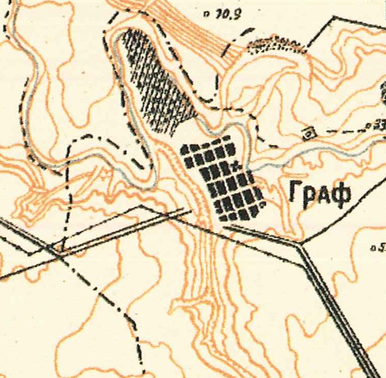
Map of Graf (1935).
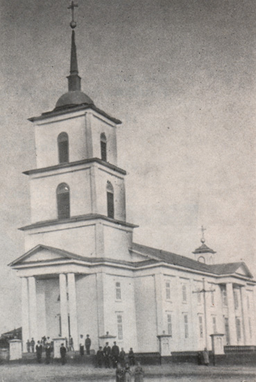
Catholic Church in Graf.
Built in 1886.
Source: Heimatbuch der Deutschen aus Rußland, 1972.
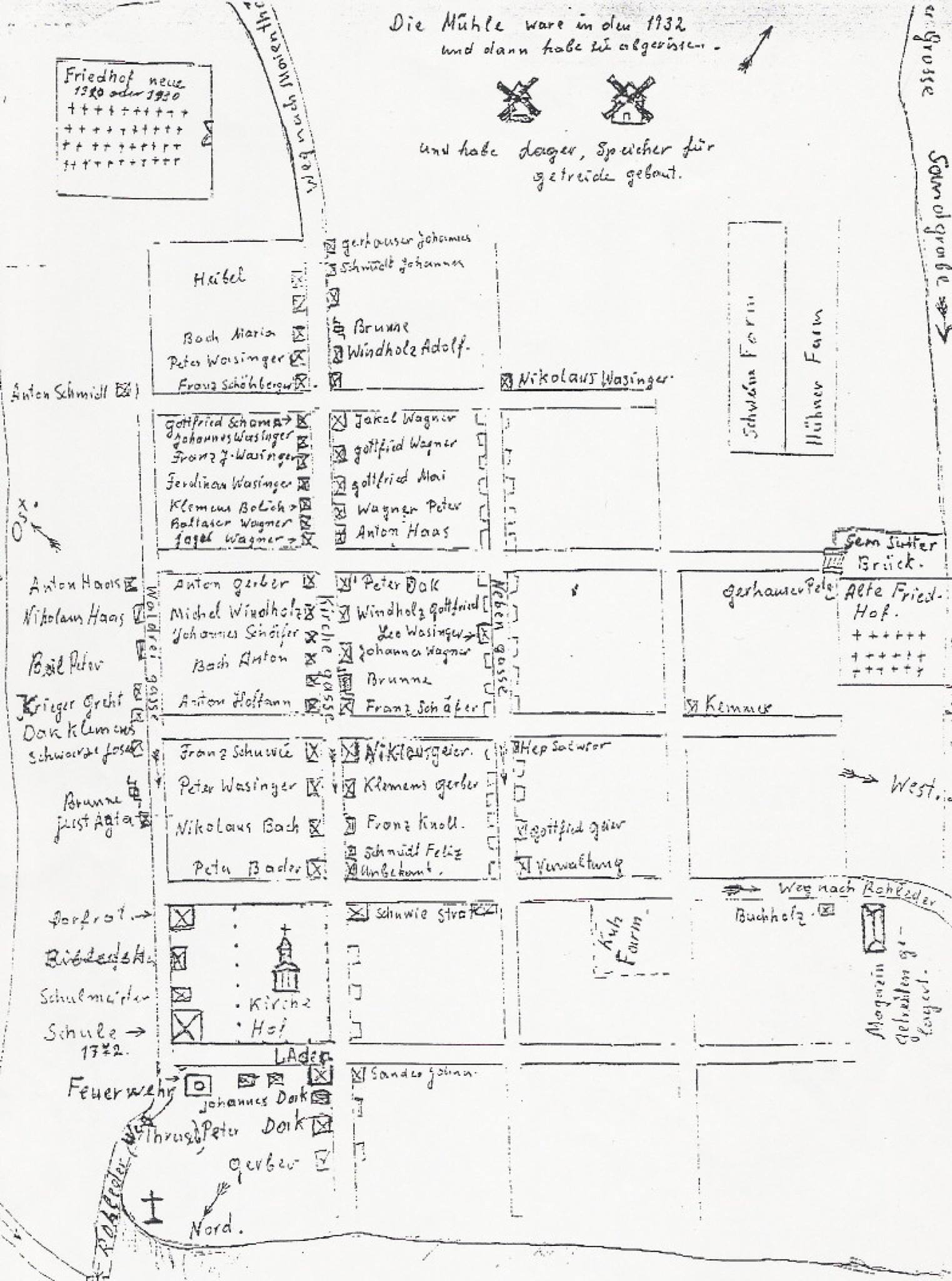
Hand-drawn map of Graf as of 1932.
Source: Jorge Bohn.