Stahl am Tarlyk
Stahl am Tarlyk was founded on 13 August 1767 by colonists recruited by LeRoi & Pictet on the banks of the Tarlyk River where it fed into the Volga River. [The creation of the Volga Reservoir in 1961 also brought about the disappearance of the Tarlyk River at this location.] There were 76 families who originally settled in Stahl. They came from Holstein, Prussia, and Denmark. It was named in honor of its first leader, Johannes Stahl.
Completion of the Volgograd (formerly Stalingrad) Hydroelectric Power Station in 1961 created the Volgograd Reservoir which flooded several former Volga German colonies including the Stahl am Tarlyk. A new village was constructed on higher ground just to the east of the former colony. What remains of the former Volga German colony of Stahl am Tarlyk is in the floodplain of the Volga River today. Some of the buildings constructed by the Volga Germans were moved to the new location on the bluff above the river.
Today, what remains of the former Volga German colony of Stahl am Tarlyk in its relocated position is known as Stepnoye.
The congregation in Stahl am Tarlyk was part of the Warenburg Lutheran Parish which had been established in 1770.
A new church was constructed in Stahl am Tarlyk in 1834 in the Kontor style.
The congregation in Stahl am Tarlyk was served by the following pastors:
- 1785-1788 Friedrich Konrad Strengel
- 1797-1825 Bernhard Wilhelm Litfass
|
Year
|
Households
|
Population
|
||
|---|---|---|---|---|
|
Total
|
Male
|
Female
|
||
| 1767 |
76
|
208
|
|
|
| 1769 |
63
|
198
|
96
|
102
|
| 1773 |
58
|
188
|
90
|
98
|
| 1788 |
|
235
|
|
|
| 1798 |
|
320
|
|
|
| 1816 |
|
480
|
|
|
| 1834 |
|
798
|
|
|
| 1850 |
|
1,195
|
|
|
| 1857 |
|
|
|
|
| 1859 |
|
1,538
|
|
|
| 1889 |
|
2,487
|
|
|
| 1897* |
|
2,447
|
1,211
|
1,236
|
| 1910 |
|
3,640
|
|
|
| 1912 |
|
4,095
|
|
|
| 1920 |
462**
|
2,770
|
|
|
| 1922 |
|
2,076
|
|
|
| 1923 |
|
2,150
|
|
|
| 1926*** |
498
|
2,432
|
1,203
|
1,229
|
| 1931 |
|
2,402
|
|
|
*Of whom 2,425 were German.
**Of which 452 households were German.
***Of whom 2,400 were German (486 households: 1,187 male & 1,213 female).
- The Nilmeier Family (Michael Patton)
- Schmidt/Scheidt Genealogy (Dick Schmidt)
- Stahl (wolgadeutsche.net) [in Russia]
- Beratz, Gottieb. The German colonies on the Lower Volga, their origin and early development: a memorial for the 150th anniversary of the arrival of the first German settlers on the Volga, 29 June 1764. Translated by Adam Giesinger (Lincoln, NE: American Historical Society of Germans from Russia, 1991): 353.
- Diesendorf, V.F. Die Deutschen Russlands : Siedlungen und Siedlungsgebiete : Lexicon. Moscow, 2006.
- Orlov, Gregorii. Report of Conditions of Settlements on the Volga to Catherine II, 14 February 1769.
- Pallas, P.S. Reise durch verschiedene Provinzen des Russischen Reichs. Theil 3,2, Reise aus Sibirien zurueck an die Wolga im 1773sten Jahr (St. Petersburg: Kaiserl. Academie der Wissenschaften, 1776): 609.
- Pleve, Igor R. The German Colonies on the Volga: The Second Half of the Eighteenth Century, translated by Richard Rye (Lincoln, NE: American Historical Society of Germans from Russia, 2001): 319.
- Preliminary Results of the Soviet Census of 1926 on the Volga German Autonomous Soviet Socialist Republic (Pokrovsk, 1927): 28-83.
- "Settlements in the 1897 Census." Journal of the American Historical Society of Germans from Russia (Winter, 1990): 17.
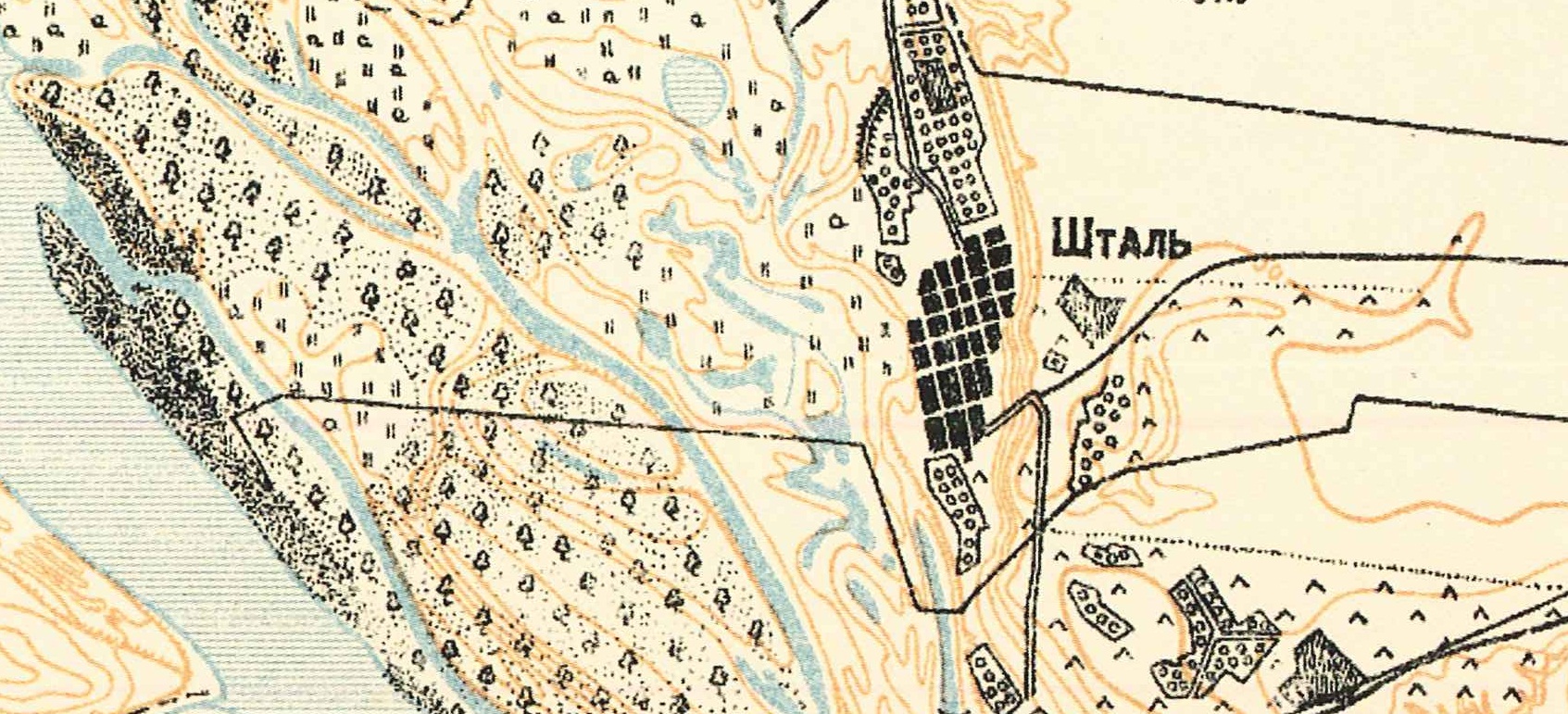
Map showing Stahl am Tarlyk (1935).
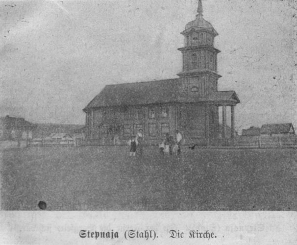
Stahl am Tarlyk Church built in 1834.
Source: Volksfreund Kalender, 1911.
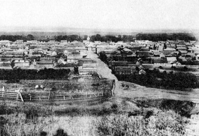
Stahl am Tarlyk panorama.
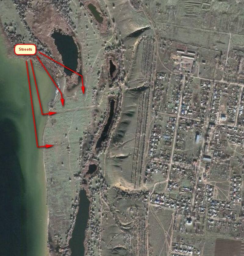
Satellite image showing the former (now partially flooded) location of Stahl am Tarlyk, along with the newer village on higher ground to the right.
Source: Vladimir Kakorin.
Comments
Please login or register to post comments.